Contents
Appendices
- Green Spaces and Getting Around - Summary of Community Responses - Nairnshire today
- Housing Evidence Report-Nairnshire Today - Nairnshire today
- Latest Scottish Census data 2022
- Report on Local Population Statistics - Nairnshire Today - Nairnshire today
- SEPA flood risk assessment Nairn Central
- Climate Change and Coastal Erosion (Nairn Community Councils discussion paper May2024) - Nairnshire today
- SEPA flood risk assessment Nairn West and Ardersier
- SEPA flood risk assessment Nairn East and Auldearn
- Dynamic Adaptive Pathways ( Nairn Coast) Highland Council Report Nov 2023
- Report of Scottish Government Examination of IMFLDP2
- Infrastructure: Flood management - LPP desk research summary - Nairnshire today
- Infrastructure: Sewage -Desk Research summary - Nairnshire today
- SEPA flood risk forecast maps
- Nairn and Nairnshire Demography 2022 (NHS Highland) - Nairnshire today
- 2011 Census (searchable IV12 data map)
- Nairn Common Good Asset Register
- Team Hamish Vision 2018 ( Phase 1 Links Development - the Splashpad)
- Nairn Links Development Plan THC Nairnshire Committee2019 - Nairnshire today
- Nairn Town Centre Plan 2015 - Nairnshire today
- Housing Need - Summary of Community Responses - How we prepared the Plan
- Community Survey questions Sept 2023 - How we prepared the Plan
- Demography of LPP consultation respondents ( age, residence) - How we prepared the Plan
- Nairn Academy survey questions June 2024 - How we prepared the Plan
- Use of Development Land - Summary of Community Responses - How we prepared the Plan
- Green Spaces and Leisure - Summary of Community Responses - How we prepared the Plan
- Jobs and Business - Summary of Community Responses - How we prepared the Plan
- Vision for Nairnshire- summary of Community Responses - How we prepared the Plan
- Online Survey 2 ( March 2024)
- Initial Community Survey questions Sept 2023
- Drop-in Information Boards - How we prepared the Plan
- Community Road Show Flyer March 2024 - How we prepared the Plan
- Data Analysis - Summary of 451 Initial Community Survey Responses - How we prepared the Plan
- Nairn Academy senior pupils survey datasetJune24(pdf) - How we prepared the Plan
- Highland Council Inner Moray Firth Development Plan (IMFLDP2 )
- 2024 Business Survey and Industry and Employment Growth Strategy for Nairnshire(Grigorhill Business Group) - The Plan
- Climate Change and Coastal Erosion ( Discussion Paper for Nairn Community Councils May 2023) - The Plan
- National Performance Framework
- Transport Scotland National Transport Strategy 2
- Highland Outcomes Improvement Plan 2017 – 2027
- Highlands and Islands Enterprise Strategy 2023 – 2028.
- Public Responses to IMFLDP2 consultation 2023
- Team Hamish ( Phase 2 Links Development) Putting Green Area
- Green Hive Community Consultation Report -Victoria Seaman's Hall 2022
- Options Appraisal (for NICE) for Regeneration of Nairn Town Centre 2022
- Sandown and Wetlands Working Group Proposals 2015 - The Plan
- Lochloy Active Travel Bridge Community Survey findings 2021 - The Plan
- Nairn and Ardersier Patients Group Local Transport Survey 2014 - The Plan
- Nairn LIDO Feasibility Study 2017 - The Plan
- Cawdor Community Survey and Action Plan 2019 - The Plan
- Inspection Report for NICE on former Police Station/Old Social Work Building 2022 - The Plan
- Keep Nairn Library Central 2022Citizen led Petition (1500 signatures -800+ online)
- Nairn Riverside Pump Track Proposal 2024 - The Plan
- Green Spaces and Leisure - Summary of Community Responses - Foreword
- Nairn Jobs Network 2021 Local Employer Survey Findings - Foreword
Give us your feedback here
We are proud to welcome you to our community led Local Place Plan: Our Nairnshire:
Explore the five plan themes
Sustainable Futures (SF)
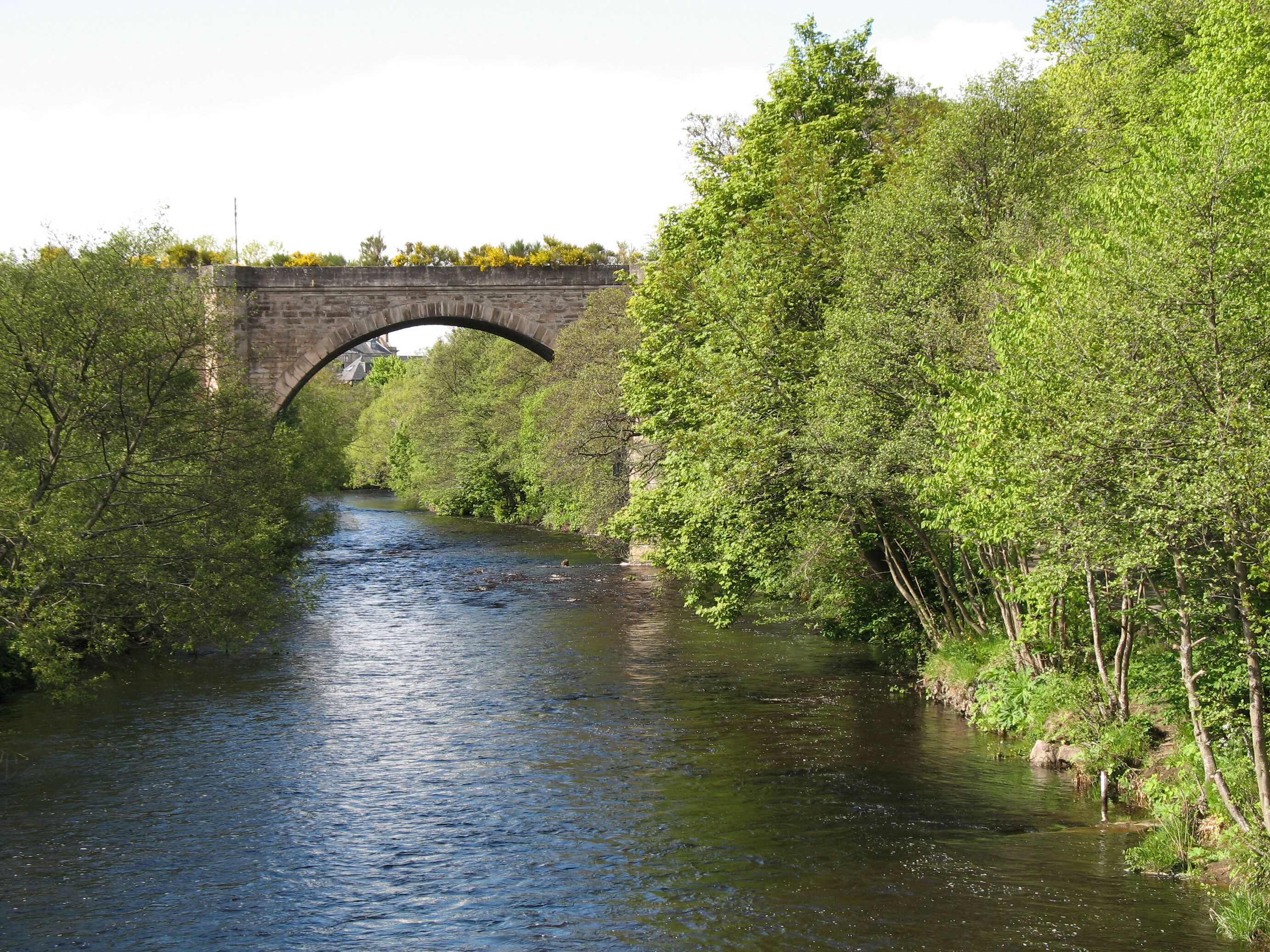
Sustainable Futures
Nairnshire communities face critical challenges in their quest for economic and environmental sustainability, driven by the climate emergency and changing demographics and the impact of A96 trunk road passing through the heart of Nairn. Addressing these issues is essential for ensuring the long-term vitality and resilience of the region.
Jobs and Business (JB)
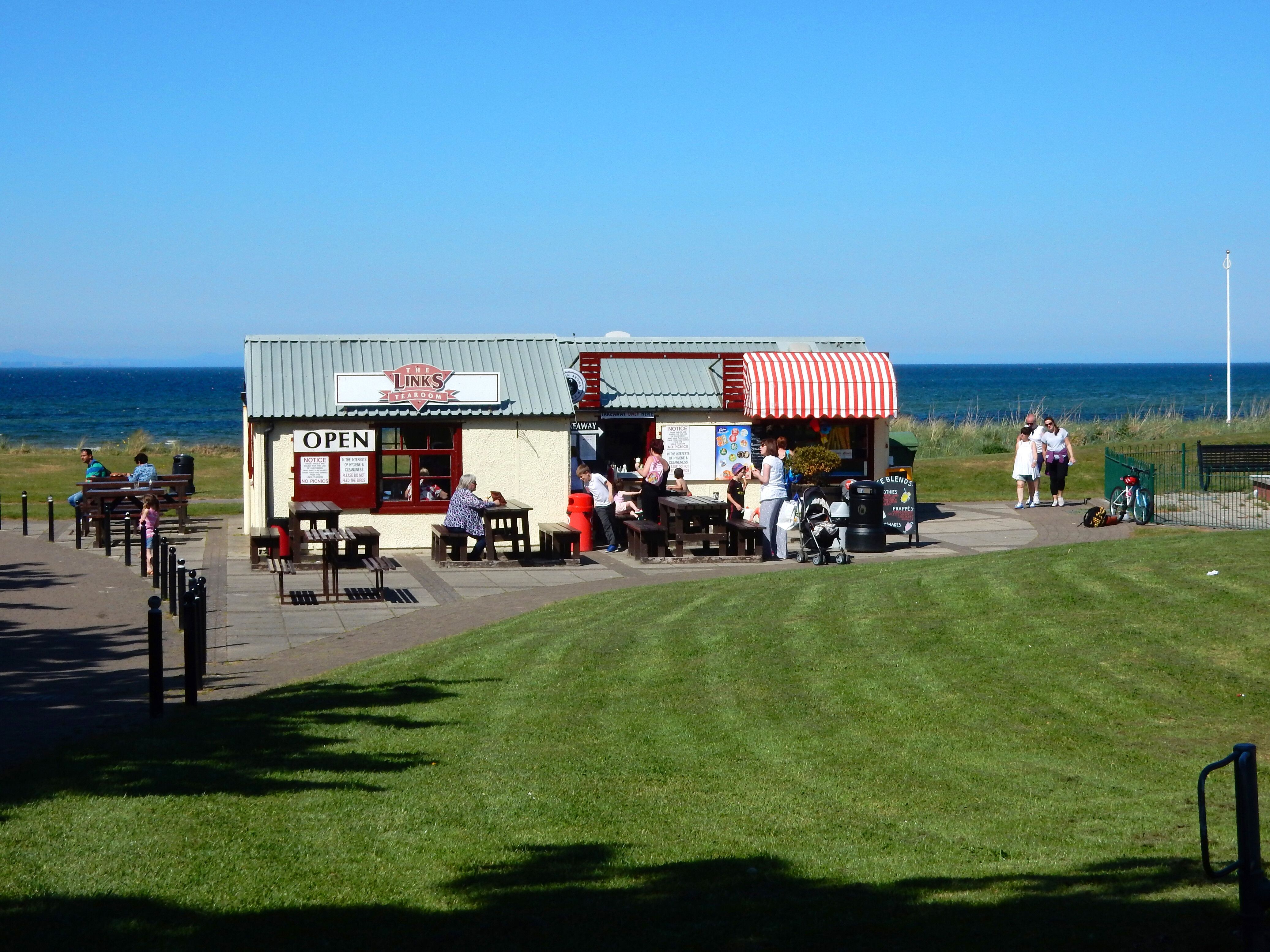
Jobs and Business
Nairn and Nairnshire face significant challenges in supporting the growth and sustainability of local businesses and job markets. Chief among these challenges is the availability of space for business expansion and the ability to fill job roles critical to supporting such growth.
Town and Village Centres (TV)
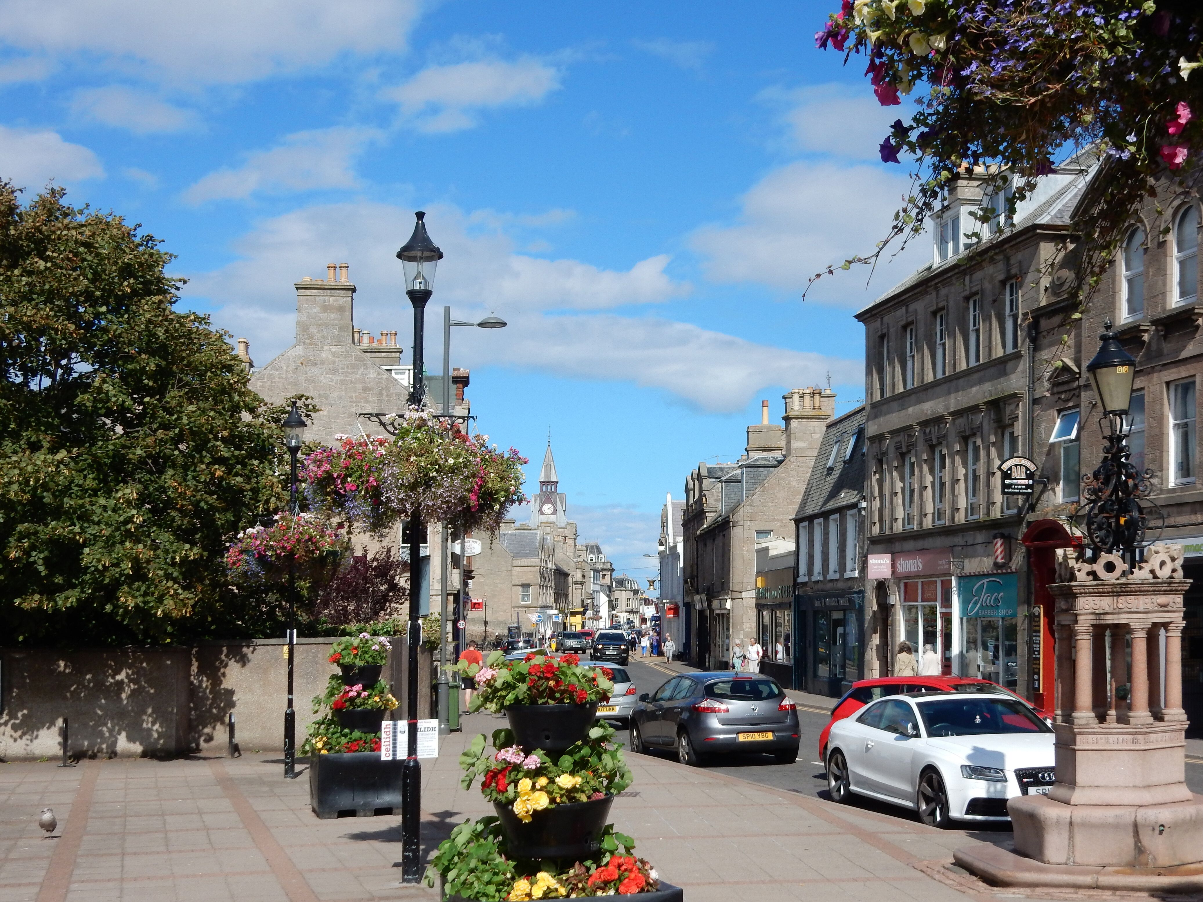
Town and Village Centres
Revitalising Nairn town centre is a high priority for the community within the town and region. As a centre for living, jobs, leisure and culture, this is a remaking of the town centre as a well-used, liveable and investable place.
Village and local hubs play a role in creating liveable places, providing people with their daily needs, and through connections, meeting all needs regionally. Key life outcomes such as health, community wealth and a sustainable environment are dependent on creating these types of places
Green Space and Leisure (GSL)
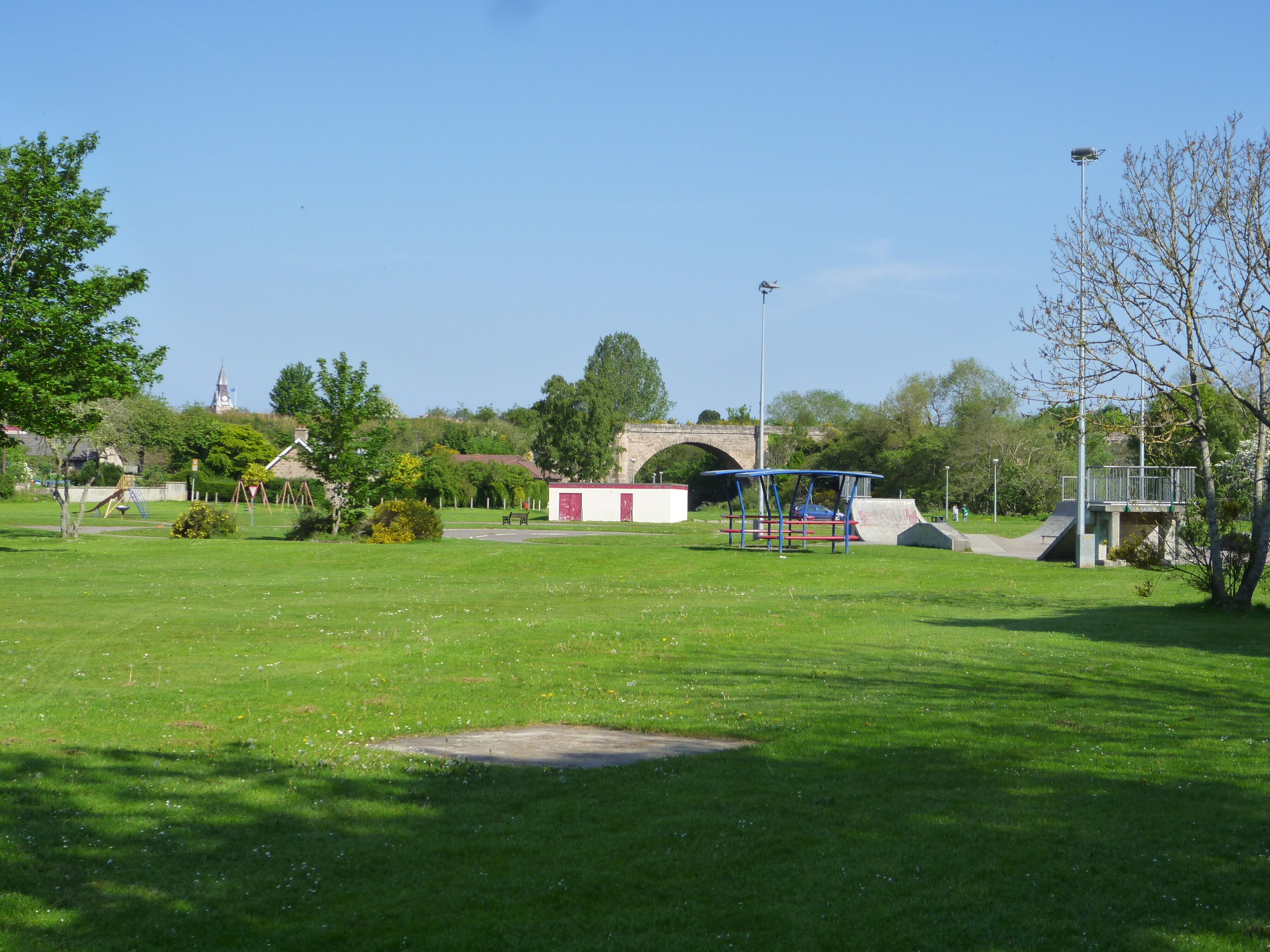
Green Space and Leisure
The community consultation has highlighted time and again that the natural environment is Nairn and Nairnshire’s greatest asset. From mountains to forests to coast, there is a wealth that can be maximised for future green business, tourism, quality of life and environmental sustainability. Within the Royal Burgh of Nairn, the Common Good land provides much of the key greenspace.
Careful stewardship is required to ensure that this continues to work for the people of Nairn, providing greenspace and natural environments, climate adaptation and mitigation opportunities, and where appropriate, development that provides a long-term good.
Getting Around (GA)
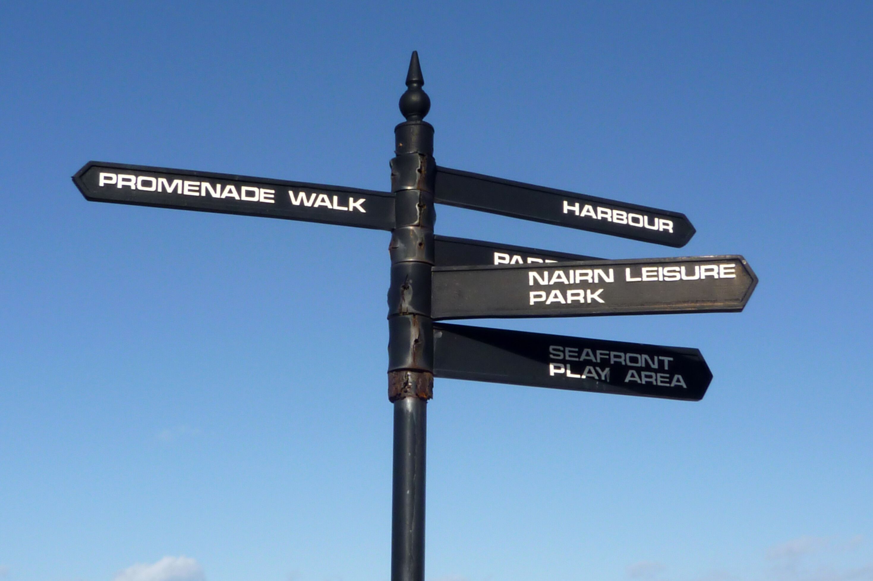
Getting Around
The A96 bypass has a very long history, and we are now at a point where it looks to be coming to reality. The implications for within Nairn are that new access and movement options open, there are great placemaking opportunities and shifting to decarbonizing internal transport. Externally, the bypass would unlock opportunities for business and homes. The case also needs to be made that the bypass plays a significant role in decarbonizing transport in the region and creating a much more liveable location.
Accessibility and connection between key assets is also very important. Transport hubs, to town centre, to beach – we want to make the most of this key axis in Nairn.

Nairnshire communities face critical challenges in their quest for economic and environmental sustainability, driven by the climate emergency and changing demographics and the impact of A96 trunk road passing through the heart of Nairn. Addressing these issues is essential for ensuring the long-term vitality and resilience of the region.
Read more
Nairn and Nairnshire face significant challenges in supporting the growth and sustainability of local businesses and job markets. Chief among these challenges is the availability of space for business expansion and the ability to fill job roles critical to supporting such growth.
Read more
Revitalising Nairn town centre is a high priority for the community within the town and region. As a centre for living, jobs, leisure and culture, this is a remaking of the town centre as a well-used, liveable and investable place.
Village and local hubs play a role in creating liveable places, providing people with their daily needs, and through connections, meeting all needs regionally. Key life outcomes such as health, community wealth and a sustainable environment are dependent on creating these types of places
Read more
The community consultation has highlighted time and again that the natural environment is Nairn and Nairnshire’s greatest asset. From mountains to forests to coast, there is a wealth that can be maximised for future green business, tourism, quality of life and environmental sustainability. Within the Royal Burgh of Nairn, the Common Good land provides much of the key greenspace.
Careful stewardship is required to ensure that this continues to work for the people of Nairn, providing greenspace and natural environments, climate adaptation and mitigation opportunities, and where appropriate, development that provides a long-term good.
Read more
The A96 bypass has a very long history, and we are now at a point where it looks to be coming to reality. The implications for within Nairn are that new access and movement options open, there are great placemaking opportunities and shifting to decarbonizing internal transport. Externally, the bypass would unlock opportunities for business and homes. The case also needs to be made that the bypass plays a significant role in decarbonizing transport in the region and creating a much more liveable location.
Accessibility and connection between key assets is also very important. Transport hubs, to town centre, to beach – we want to make the most of this key axis in Nairn.
Read moreNairnshire: LPP area and important sites
Click the button on the map to interact with itForeword

“Nairnshire is a special place with its own proud identity and history. It is dear to the heart of many who have left their home area to make their way in the world–but it always calls them back.
It has welcomed many people over the decades and has seen growth in population, attracted by the pleasing landscape of rolling and fertile farmland and forest, of beautiful beaches and magnificent golf courses. Its people have a calm and friendly manner, approaching the perils and frustrations of life with optimism and good cheer.
I know that my mother, Winnie, who passed away just last June, was very fond of Nairn and many characters with whom she worked when MP 50 years ago–some of whom, I am pleased to say, are still with us now.
This plan looks at things as they are and forward to what they may be. It’s clear the plan is based upon the Nairn bypass alleviating the congestion problems that have become so acute and a problem in so many ways. Not everyone agreed with the line of the bypass–I know some bitterly opposed it. But it has eventually been agreed after the long planning process, and at a recent public meeting I attended, it was clear that the overwhelming majority of Nairn folk now just want it done–and an end to the seemingly endless delays that I have challenged and will again as necessary.
The plan does not seek Nairn to lose its character; it does not want to become an industrial town, nor a retirement town; nor a mere satellite of Inverness. It seeks organic growth; building upon existing strengths and the established local businesses that are valued by the community, and of course the building of the new school!
I commend this vision and look forward to hearing more views from Nairnites about its content and proposals. As your constituency MSP I will continue to work with all involved to seek the improvements needed, and to collaborate together to make that vision a reality.
I close with a wee poem containing four fine sentiments–ones which to me have always encapsulated the friendly spirit of Nairn folk, and which I first came across in the local Museum, engraved on a glass rolling pin, a traditional engagement gift to a bride to be in days long gone by!
Health to the sick
Freedom to the slave
Success to the lover
Honour to the brave”
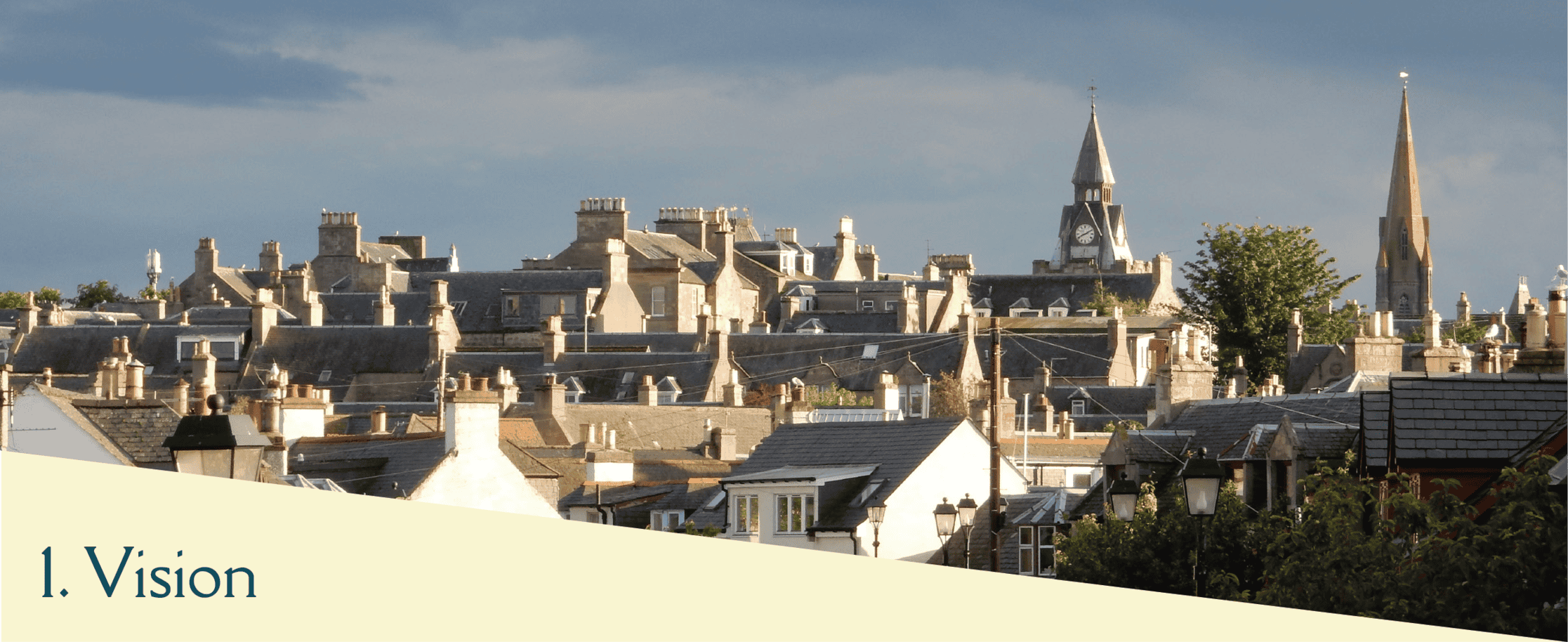
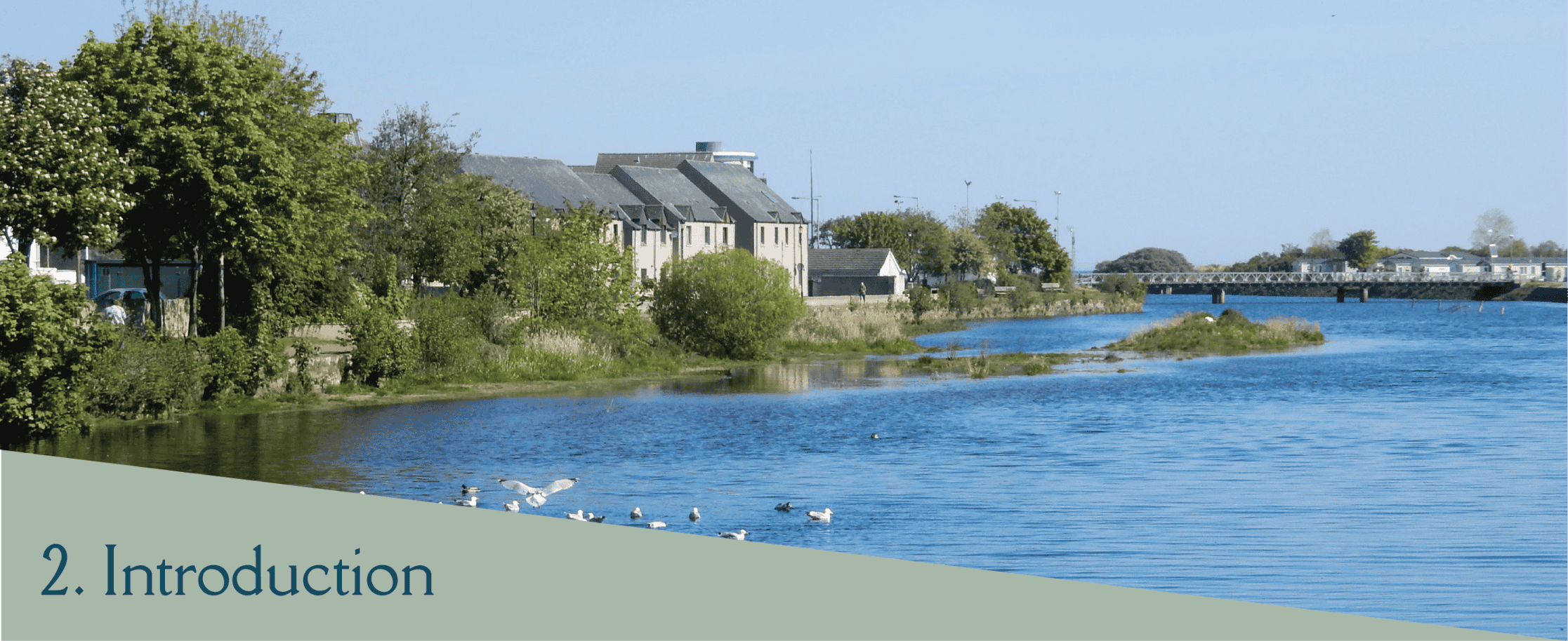
Vision Statement for Nairn
Our vision for Nairn is to create a vibrant, welcoming community that sustains and nurtures its residents, visitors, employers, and investors. We aim to provide a thriving environment where people can live happily, businesses can prosper, and the local economy flourishes.
To achieve this, we will:
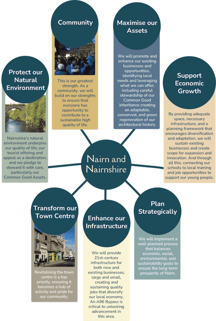
2.1. This Local Place Plan is
A Statement of Strategic Ambition
Clearly outlining the community’s long-term goals and aspirations
The Beginning of a Pathway for Delivery
Setting out initial steps and a roadmap for achieving these goals
A Guide for Development and Preservation
Informing how land, buildings, and their uses should evolve to meet community needs and aspirations
Evidence-Based
Grounded in data and insights gathered by community members over many years, ensuring that our proposals are both realistic and reflective of local knowledge.

Figure 3. Nairnshire boundary served by Our Nairnshire Local Place Plan
Our Plan is the collective vision for the future of Nairn and Nairnshire, defined by the boundaries of the 5 community councils Nairn River, Nairn West and Suburban, Auldearn, Cawdor and West Nairnshire, East Nairnshire (link to map). It is rooted in the values and aspirations of those who live and work here. By aligning with national goals and leveraging the unique strengths of our community, we aim to create a place that is vibrant, sustainable, and resilient for generations to come.
2.2. Key Priorities
Our key priorities identified throughout the plan are:
- to address the infrastructure deficits, including building the A96 by-pass;
- regenerate our town and village centres, creating vibrant places to live, work and visit for all ages;
- deliver the places needed for a sustainable community, through ensuring there is space for jobs and business, homes that meet need and a sustainable lifestyle;
- to create the conditions for our community groups and organisations to continue delivering on health, wellbeing and stewarding our natural environment.
These key priorities are addressed through the analysis of community feedback collected during Stage 2 of the community consultation. This revealed five key themes that reflect community priorities and form the foundation of the Local Place Plan. These themes were used to structure the plan and identify specific projects and ideas. To support the interpretation of the Plan, we have brought forward Sustainable Futures as a contextual lead theme, with the remaining key themes as they came forward with descending priority.

Sustainable Futures
Promoting sustainability, resilience, and environmental stewardship, but also sustaining a population.

Jobs and Business
Focusing on creating the space and conditions for businesses to expand and accommodate growth, business support, and employment conditions.

Town and Village Centres
Revitalising town and village centres to create vibrant, attractive, and functional places. Sustaining and protecting village facilities.

Green Space and Leisure
Enhancing green spaces for recreation, nature, and community wellbeing.

Getting Around
Improving transportation infrastructure and connectivity for all modes of travel.

Promoting sustainability, resilience, and environmental stewardship, but also sustaining a population.
Read more
Focusing on creating the space and conditions for businesses to expand and accommodate growth, business support, and employment conditions.
Read more
Revitalising town and village centres to create vibrant, attractive, and functional places. Sustaining and protecting village facilities.
Read moreOur five key themes each have implications for local housing, and tourism and culture and heritage in physical planning. Our themes, and these cross-cutting themes are explored in more detail, where we identify the challenges facing Nairnshire, set against action points which will support the creation of the sustainable future of Nairnshire that we want.
Additionally, the Plan acknowledges the potentially significant and long term impacts of the Moray Firth Green Free across the Port of Ardersier Port, the Cromarty Firth and the Inner Moray Firth. This could be very positive in terms of local job creation, but could add considerable pressure to already stretched local infrastructure across Nairnshire, including both A96 and rural road congestion, housing, and utilities and community infrastructure. Local people also raised their concerns around marine industrial operation bringing the risk of serious damage to fragile natural coastal environments and the marine ecosystem, which may directly impact the quality of life for our local communities, as well as our tourism dependent businesses.
Before we move into the full detail of our themes, it is critical to the context and application of the Plan to understand Nairnshire Today.

This Local Place Plan has a dual challenge – to address deficits that have been identified by the community across Nairn and Nairnshire to meet existing needs, to plan for the provision of increased infrastructure capacity, space for business expansion, and to protect the green spaces that make Nairnshire to meet the needs of our community, supporting the delivery of the future vision for Nairn and Nairnshire.
This section sets out some of the challenges and pressures that are being experienced or are anticipated. There are evidence bases from Key Agencies and community led datasets. This is all structured here under the plan’s key themes. Links to the full evidence base and supporting documents are listed at the end of this Plan.
3.1. Sustainable Futures
Our Challenge
Nairnshire communities face critical challenges in their quest for economic and environmental sustainability, driven by the climate emergency and changing demographics and the impact of A96 trunk road passing through the heart of Nairn. Addressing these issues is essential for ensuring the long-term vitality and resilience of the region.
Climate Emergency:
Coastal and River Flooding: The increasing frequency and severity of coastal and river flooding present significant risks to the community. Future flooding risk is modelled and published by SEPA. Effective and affordable solutions are needed to mitigate these impacts, including improved flood defences, natural flood management techniques, and comprehensive emergency planning.
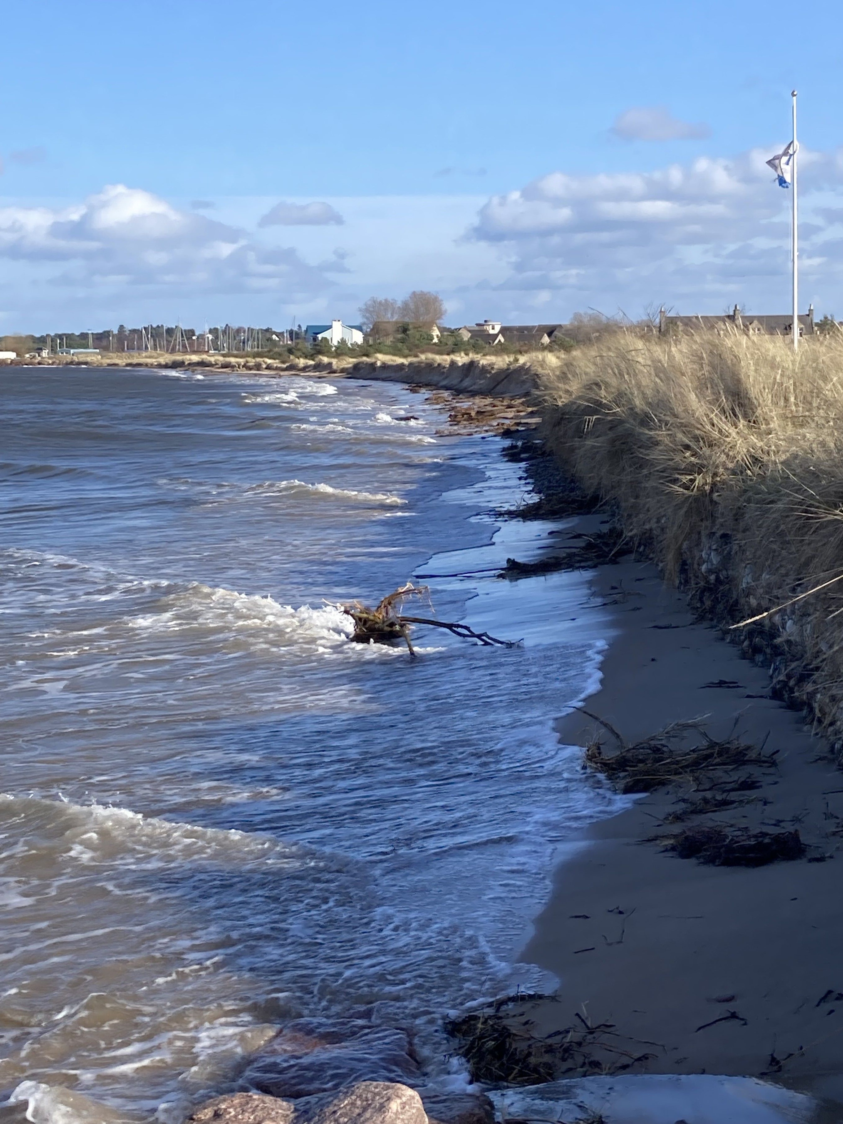
Investments in infrastructure that can withstand extreme weather events are crucial. This includes upgrading drainage systems, reinforcing riverbanks, reinforcing and supplementing dunes, and implementing sustainable urban drainage systems (SUDS). The extent and rate of coastal erosion on Nairn’s east and west beaches has been assessed and is published in this report Dynamic Adaptive Pathways . The findings and recommendations of this report reflect the overall approach to managing coastal erosion in Scotland from the work being carried out by Dynamic Coast. There is a need to recognise that defending against or preventing floods may no longer be possible in all cases, therefore building resilience within our communities to adapt to change or preparing for change may be the best way forward. This aligns with the Scottish Government’s Flood Resilience Strategy Consultation.
Sustainable Urban Development:
Aligning with the National Planning Framework 4 (NPF4), Nairn must evolve into a sustainable, walkable, and liveable town that meets the needs of its residents while minimising environmental impact. Embracing green building practices, increasing green spaces, and promoting renewable energy sources are essential steps toward reducing the town’s carbon footprint. Removing A96 congestion from the town and surrounding rural routes is also key to this.
Regenerating the fabric of Nairnshire
Repurposing
Engaging and empowering the existing fabric of the town of Nairn and Nairnshire to create an adaptable, vibrant, and sympathetic enhancement of Nairn and Nairnshire as a place to live, work, and relax.
Conservation
Embracing our history as reflected in our architecture, from the Fishertown through the Victorian spa town to our High Street and conserving that tapestry through sensitive modernising to serve new purposes in a green and low carbon future.
Cawdor is also a Conservation village with heritage to be protected and enhanced.
Our community can see a whole new life in a repurposed, conserved, and rejuvenated town and shire architecture.
3.2. Changing Demographics:
Attracting a Younger Population:
To counteract an ageing population and ensure a vibrant future, Nairn needs to attract and retain younger residents. This involves creating an appealing living environment with a variety of housing options that cater to different life stages and economic situations.
Providing high-quality jobs is crucial. This can be achieved by fostering a diverse economy, supporting local businesses, and encouraging new enterprises that offer opportunities for professional growth and career development.
Enhancing Quality of Life:
Nairn must position itself as an attractive place to live by enhancing amenities, recreational opportunities, and cultural offerings.This includes developing parks, sports facilities, and community centres that foster a sense of belonging and well-being. Ensuring excellent educational facilities and healthcare services will make Nairn a desirable place for families and young professionals.
3.3. Jobs and Business
Our Challenge
Nairn and Nairnshire face significant challenges in supporting the growth and sustainability of local businesses and job markets. Chief among these challenges is the availability of space for business expansion and the ability to fill job roles critical to supporting such growth.
From our surveys and consultations with local businesses it is evident that these challenges are pervasive across all sectors, including hospitality, retail, services, and industrial operations. Specific issues identified include:
Limited Space for Expansion
Businesses are struggling to find adequate physical space to expand their operations. This limitation stifles growth and innovation, preventing companies from scaling up and increasing their capacity to serve both local and broader markets. The scarcity of commercial and industrial land also hampers new businesses from setting up in Nairn, deterring potential investors and entrepreneurs..
Workforce Shortages
There is a critical shortage of skilled workers to fill essential roles across all sectors. This gap hinders the ability of businesses to operate at full capacity and meet the demands of expansion. Challenges in attracting and retaining talent are exacerbated by factors such as housing availability, transportation, and access to training and development opportunities. In the hospitality sector, seasonal fluctuations and the demand for part-time versus full-time employment create instability and challenges in workforce planning.

Infrastructure and Accessibility
Insufficient infrastructure, including transportation networks and digital connectivity, poses a barrier to business efficiency and growth. Improving accessibility and ensuring robust infrastructure is crucial to support expanding businesses and attract new enterprises to the region.
3.4. Getting Around
Our Challenge
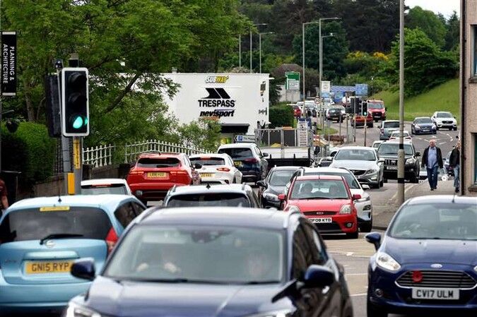
Nairn faces significant transportation challenges, with the A96 running directly through the town centre. This creates multiple issues, including congestion, poor air quality, limited connectivity for active travel across the A96, and obstacles to high-quality placemaking along King Street. To overcome these challenges and move towards a more sustainable future, a multifaceted approach is required.
1.Mitigating the Impact of the A96:

Congestion Reduction
The heavy traffic on the A96 leads to frequent congestion in the town centre, negatively impacting local businesses and the overall liveability of the area. Some of these issues are explored in the Nairn Active Travel Masterplan, however, in developing this Local Place Plan, priorities are updated. Effective traffic management solutions, such as rerouting heavy vehicles( challenging in the Nairnshire context) and optimising traffic signals, can help alleviate congestion.
Improving Air Quality
High levels of vehicular traffic contribute to poor air quality, which poses health risks to residents and detracts from the town’s appeal. Implementing measures such as green corridors, increased tree planting, and encouraging the use of electric vehicles can help improve air quality.
Placemaking along King Street
The presence of the A96 hinders efforts to create a vibrant, attractive town centre along King Street. Traffic calming measures, improved public spaces, and enhanced streetscaping can help transform King Street into a welcoming and dynamic area.
Transitioning to Sustainable Transport:
Adopting Transport Scotland’s Travel Hierarchy
Moving away from a car-centric model to Transport Scotland’s Travel Hierarchy requires significant changes in infrastructure and mindset. Prioritising walking, cycling, and public transport over private car use is essential for sustainable development.
Developing a Quality Network of Routes
A comprehensive, well-connected network of routes for walking and cycling must be established. This includes safe, direct paths that are easily navigable and linked to key destinations such as schools, shops, and public facilities.. Creating well-designed crossings, dedicated bike lanes, and pedestrian-friendly pathways can improve connectivity and encourage active travel.
Role of Private Cars:
Reducing Car Dependency
While private cars will continue to play a role in Nairnshire’s transportation system, efforts should be made to reduce reliance on them. This can be achieved by promoting improving public transport to all parts of Nairnshire and nearby towns, carpooling, providing ample parking for bicycles, and developing park-and-ride facilities on the outskirts of town.
3.5. Town and Village Centres
Our Challenge
Across the country, town and village centres have faced significant challenges in reinventing themselves as viable, vibrant locations. Development patterns, favouring “convenience” sites on the outskirts of towns and housing developments increasingly distant from central areas, have compounded these pressures. The viability of these centres hinges on footfall and a regular population that uses and enlivens them.
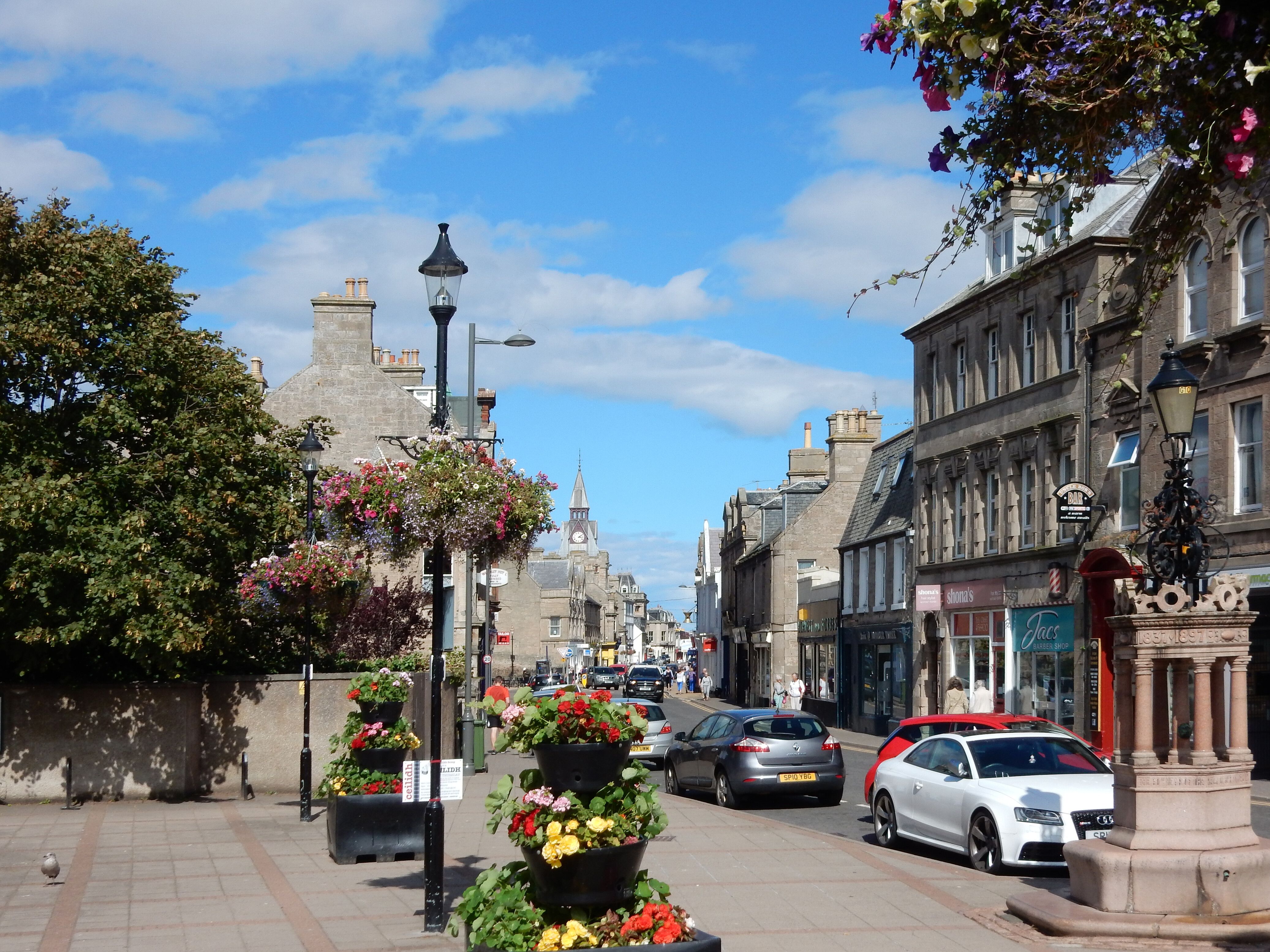
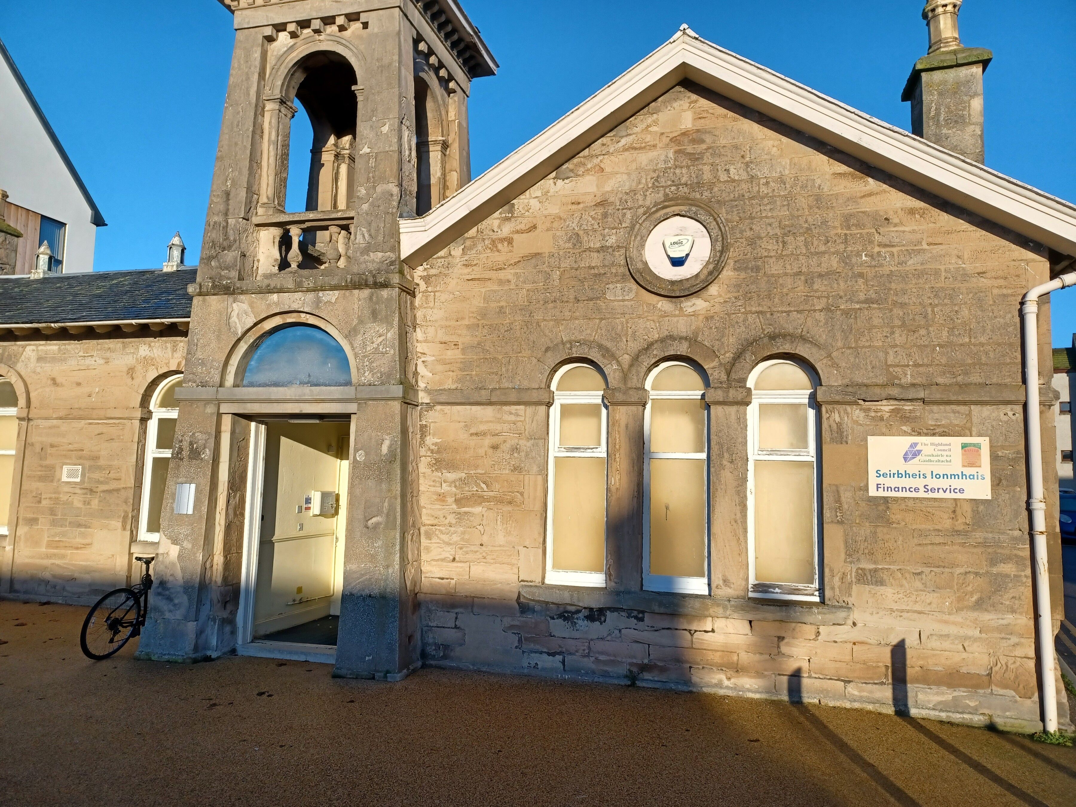
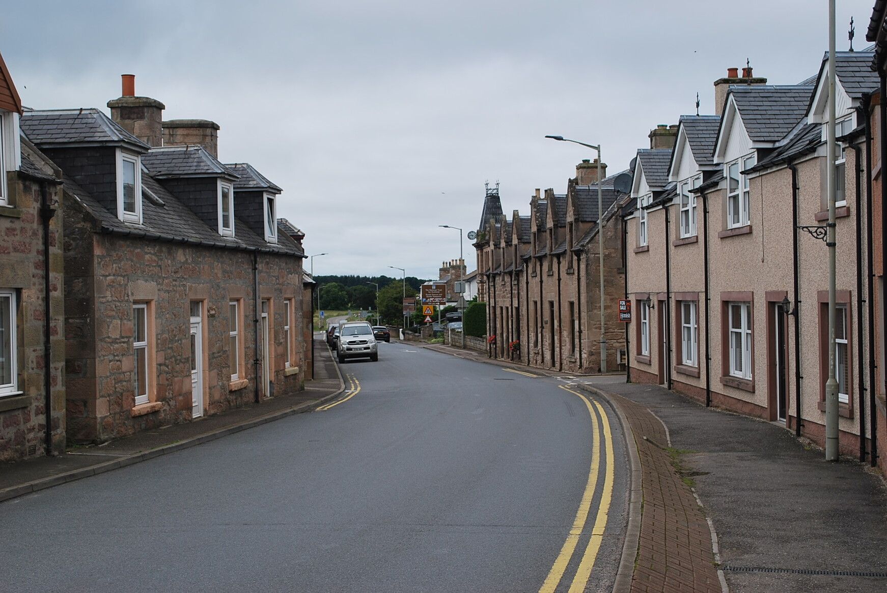
Increasing Footfall
The success of town centres like Nairn, relies on attracting a steady stream of visitors and residents who engage with local businesses and public spaces. This can be achieved by creating a mix of retail, dining, entertainment, and residential options that draw people in and encourage them to spend time in the area.
Leveraging Heritage Assets
Nairn town centre boasts an abundance of listed buildings that represent a rich historical and cultural heritage. Maximising the value of these assets involves not only preserving and restoring them but also repurposing them for modern uses that attract visitors and businesses. This could include converting historical buildings into boutique hotels, galleries, cafes, or coworking spaces.
Creating Vibrant Public Spaces
Developing attractive, accessible public spaces where people can gather, relax, and participate in community activities is essential. Enhancing parks, squares, and pedestrian zones can create a welcoming environment that encourages foot traffic and social interaction.
Revitalising Village Centres:
Retaining Community Spaces
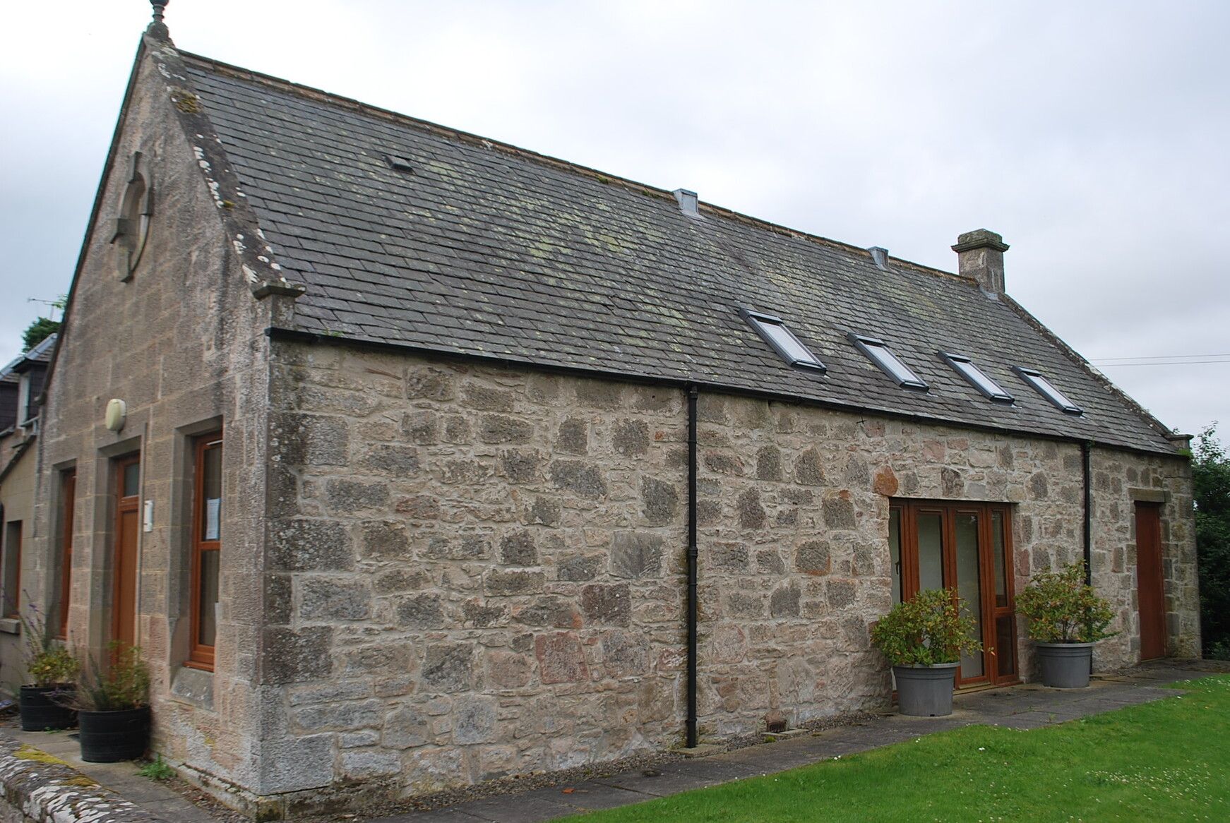
For villages, the challenge lies in maintaining and enhancing spaces for community activities. As economic viability becomes more difficult, creative approaches are necessary to conserve important areas that support communal life. This might include multipurpose community centres, shared spaces for local events, and flexible venues that can host various activities.
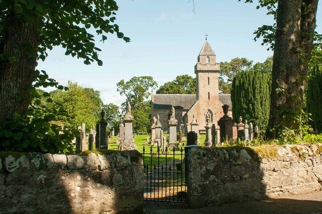

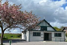
3.6. Green Space and Leisure
Green spaces in Nairn and Nairnshire perform a multitude of essential functions. They serve as venues for sports and recreation, support nature and biodiversity, attract tourists, promote leisure activities, and enhance health and wellbeing by providing an attractive environment. The region’s green and natural environment is widely recognized as a key asset, and its stewardship, enhancement, and conservation are paramount community concerns.
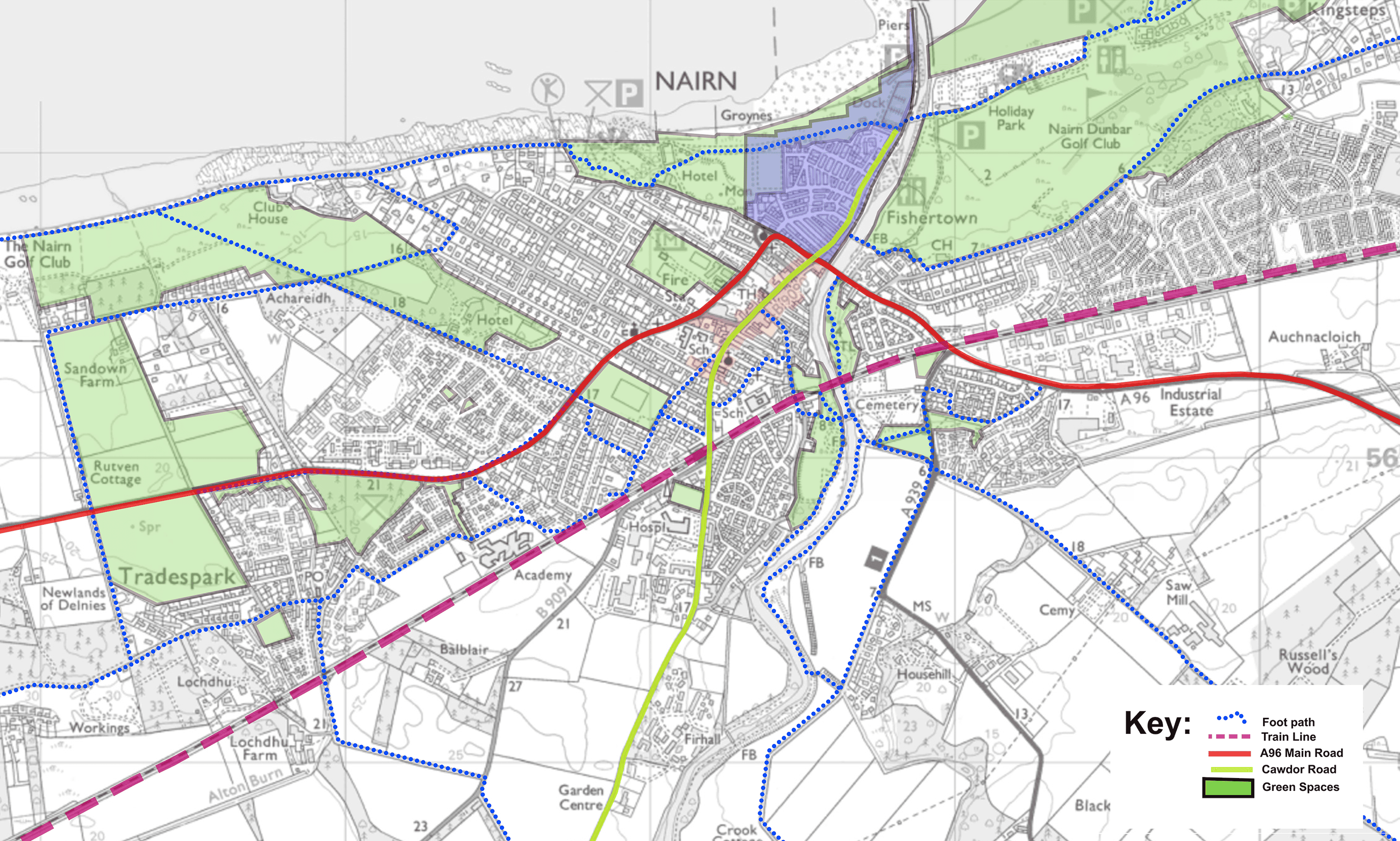

Functions of Green Spaces:

Green Space Stewardship & Conservation
Enhancement and Stewardship
Ongoing efforts to enhance and maintain green spaces, which in the town of Nairn are mainly Nairn Common Good Assets are crucial. This includes community involvement, sustainable management practices, and regular upkeep to ensure these areas remain valuable assets. This has already been done across a number of greenspaces in Nairn, and there is appetite for more.
Conservation
Protecting existing green spaces from development pressures and environmental degradation is essential. Conservation strategies, working in conjunction with Nature Scot, should focus on preserving natural habitats and ensuring that future generations can enjoy these spaces.
Addressing Flooding Challenges:
Vulnerable Areas
Coastal and river flooding poses significant risks to areas like The Links, the Maggot, and the Riverside. Developing appropriate strategies to protect these areas is complex but necessary. Coastal erosion of our beaches most likely will entail building the natural resilience of the dunes and repairs to existing engineered structures. Riverine flood management approaches could include building flood defences, creating natural flood management systems, and using certain areas for flood attenuation to minimise damage during extreme weather events. A balanced approach that combines infrastructure with natural solutions will be most effective.
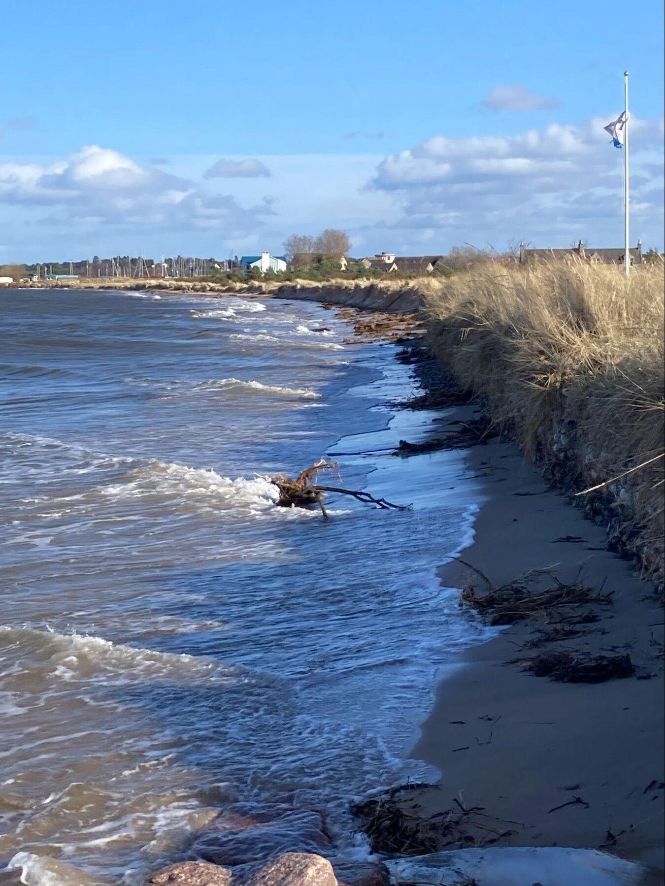
Investment in Green Space Infrastructure:
Understanding Needs
Assessing the community’s needs and setting priorities for investment in green space facilities is vital. This includes gathering input from residents and stakeholders to ensure that investments align with community desires and requirements. Strategic planning is required to allocate resources effectively. Priorities should focus on enhancing accessibility, improving existing facilities, and creating new amenities that support diverse uses of green spaces.
Appendices
Policy Alignment
We have taken into consideration and aligned policy and place proposals with the National Planning Framework 4 (NPF4), Highland Wide Local Development Plan (HwLDP), and the Inner Moray Firth Local Development Plan 2 (IMFLDP2). The following proposals have been coded to indicate how they align with and deliver on the strategic policy from both of these documents.
From NPF4:
- Sustainable Places
- Liveable Places
- Productive Places
From IMFLDP2:
- Environment
- Employment
- Growing Communities
- Connectivity
We have also considered the 6 Criteria of Successful Places and these other NPF4 Policy outcomes, although not coded here:
- Just Transition
- Conserve and Recycle Assets
- Local living
- Compact Urban Growth
- Rebalanced development
- Rural Revitalisation
The plan also takes into consideration:
Interpreting the Plan
The Plan is built using a tabular key for each priority action that has been developed during the consultation process.
Delivery Index
The Plan incorporates a Delivery Index (‘DI’). The DI is a simple index, formed in the manner of a traditional risk assessment tool:
- on the X axis, we read Difficulty. This means how difficult will it be for the community to leverage any project
- on the Y axis, we read Cost. This means an estimation of how expensive any project may be to implement. This is a broad layman’s assessment, not a detailed cost study output
The basic grid looks like:

Each project listed within the Plan includes a simple DI reference, which is shown in the table below.
The tabular key is explained here:
| Proposal Code & Name | Using the theme initials, and priority number. For example, Priority 3 in Green Space & Leisure = GSL3 | Delivery Index: 5 (see grid above) |
|---|---|---|
| Description | A brief description of the priority action. | |
| Location | A brief description of the site location. | |
| Strategically Important Site(s) | Reference to Section Y, Strategically Important Sites index of sites | |
| Delivery Partners | A list of delivery partners, for example, Highlands and Islands Enterprise | |
| Stage | The stage where the Plan, and future community actions, can make an impact. For example, the A96 By-Pass is a National project, whilst signposting and linking up accessible routes is a Local project. | |
| Timescale | A headline duration expectation of when we might see delivery of any action, for example the A96 By-Pass may be Long Term, whilst Harbour Business Uses may be Short to Medium. |
The Legend is described here:
| Abbreviation | Meaning |
|---|---|
| ACC | Auldearn Community Council |
| BID | Nairn Business Improvement District |
| CWNCC | Cawdor and West Nairn Community Council |
| CGRP | Common Good Reference Group |
| DYW | Developing the Young Workforce |
| GH | GreenHive, the sustainability focused community group who operate the Seamans’ Hall, Wheels In Nairn, and plastics recycling centre |
| HES | Historic Environment Scotland |
| HIE | Highland & Islands Enterprise |
| IMFLDP2 | Inner Moray Firth Local Development Plan 2 |
| THC | The Highland Council |
| LDP | The Highland Council Local Development |
| Local | A project that will be managed and financed by a local community body through its own fundraising |
| Long [Term] | A project which may be anticipated to be delivered within the subsequent 10 years following adoption of this Plan |
| Medium [Term] | A project which may be anticipated to be delivered within the subsequent 7 years following adoption of this Plan |
| NPF4 | National Planning Framework 4 |
| National | A project that will be financed and determined at a national level by the Scottish Government |
| NAP | Nairn Access Panel |
| NA[XX] | References to site denominations in the Inner Moray Firth Local Development Plan 2 |
| NCP | Nairnshire Community Partnership |
| NE | The rural geographical area of East Nairnshire, which does not currently have a community council |
| NICE | Nairn Improvement Community Enterprise |
| NRCC | Nairn River Community Council |
| NWSCC | Nairn West and Suburban Community Council |
| OR | Open Reach, who build and maintain the digital network across the UK |
| Regional | A project that will be financed and determined at a local government level by The Highland Council and/or other regional public bodies, such as Highland and Islands Enterprise, NHS Scotland, etc. |
| SDS | Skills Development Scotland |
| SEPA | Scottish Environmental Protection Agency |
| SIS | Strategically Important Sites, which is at Section [x] |
| Short [Term] | A project which may be anticipated to be delivered within the subsequent 3 years following adoption of the Plan |
| SW | Scottish Water |
| TH | Team Hamish |
| UHI | University of the Highlands and Islands |
4.1. Cross Cutting Themes
Housing
Community FeedbackThe community consultation identified a strong preference across all sections of the community and across the full geographic area:
- the A96 cutting through Nairn, with its associated congestion, air quality reduction, and impact on active travel makes any significant housing and population growth impossible before any by-pass for Nairn and de-trunking of the existing A96 route through the town
- regeneration and consolidation of existing buildings with housing potential is preferred to further major new-build
- the overwhelming majority of respondents were strongly against further Nairn edge of town expansion through major housing developments
- local developments around Nairn and throughout Nairnshire are welcome where they can be demonstrated to meet a housing need and are designed in accordance with the design brief to be delivered as an output of the Plan
- priority housing must be given to town and village centre regeneration of existing empty or neglected buildings, including bringing to market for social housing, open market rent, or open market sale of refurbished 1 and 2 bedroom flats
Short Term Lets
NICE acknowledges:
- a mixed response from the community for any restriction on Short Term Lets
- local pressure to balance competing needs for tourist accommodation and for local families and key workers
- current legislation around Short Term Let licensing
- the Highland Council's Ward 20(Badenoch and Strathspey) short-term let control area
Following adoption of the Plan and within 12 months of recruitment of a Development Officer, NICE, in partnership with The Highland Council, will commission an impact assessment of a similar STL control programme for Nairn, which shall seek to define:
- impact on housing supply by a restricted STL capacity
- impact on tourism by a restricted STL capacity
- impact of a hybrid, including STL restricted areas across Nairnshire
The findings of this impact assessment, with a detailed recommendation will be published for community review and forum for acceptance.
Tourism, Culture, and Heritage
Nairn has long been a favourite Highland tourist destination, with its beautiful beaches, access to the Cairngorms, and one of the driest climates in Scotland. Well known in the 20th century for attracting the great Charlie Chaplin on his family holidays, Nairnshire’s holiday destination status was first cemented in the 1860s, following Dr Grigor’s orders for his patients to take benefit from the warm, dry climate and salt water bathing. Key events in the tourist and local diary include the Nairn Farmer’s Show, first held in 1798, and the Nairn Highland Games, running since 1867 and the more recent addition of the popular Wheels of Nairn car show, all of which bring in thousands of visitors each year
The cultural offering includes the popular annual Book & Arts Festival. Nairn Community & Arts Centre hosts year round art exhibitions, cinema, music, drama and community groups and classes for all ages, whilst in the Fishertown, the Little Theatre performance calendar culminates each year in the Christmas panto. Also in Fishertown, the Wasps Centre provides studios and creative coworking space for artists.
Nestled between the capital cities of Moray and Highland, Nairnshire is well served by Inverness Airport, on the A96 and its proximity to A9 trunk roads and major bus routes, and the train station on the Aberdeen-Inverness line now has an airport stop.
Modern draws include golf, well served by the Nairn Golf Club, Nairn Dunbar Golf Club, and the Cawdor Castle 9-hole pitch and putt
Nairnshire has a deep and multi-layered heritage, from Nairn’s Fishertown (CON10), to Cawdor and Kilravock Castles and their estates. The history of the town may be traced back beyond possible founding by Sigurd, Earl of Orkney.
Nairn Museum, currently situated in Viewfield House, provides an informative resource for local history, archaeology and cultural exploration throughout Nairnshire.
The clear strategic connection to the sea and flat coastline has a shared military history with much of the Inner Moray Firth, and the 1944 D-Day Normandy landings were rehearsed on our beaches - a far cry from our busy shoreline of wild swimmers, paddle boarding, kayaking, pleasure boats, dolphin sightings and our annual Basking Shark visits.
Ensuring that Nairnshire’s tourist welcome improves from what is generally considered a poor offering is key to ensuring the long-term sustainability of Nairn and Nairnshire. This might include:
- improved public toilet provision
- improved accessibility and sign posting throughout the town and ‘shire
- beach front facilities, including lockers and showers
- an effective local parking strategy to ensure that motorhome tourism brings real benefit to the area
- a robust, collaborative, and effective tourism strategy to be developed as a priority between NICE and BID
Green Freeport
The Ardersier Port site, part of the wider Inverness and Cromarty Firth Green Freeport proposals for industrial development, whilst located in neighbouring Ardersier & Petty Ward, has the potential to significantly impact the Nairn and Nairnshire environment and economy adding increased pressure to:
- housing and accommodation
- increased burden on public services, including health care
- an over-capacity transport and utilities infrastructure network
- NICE and community concerns for a negative impact on marine life, biodiversity and the fragile coastal natural environment that underpins Nairn’s local quality of life, tourism, hospitality and rural industries
Renewed activity in the Port of Ardersier may also support Nairnshire’s endeavours to create and sustain economic growth, including:
- highly skilled job creation
- training opportunities and youth retention
- trickle down job creation in the supply chain and service sectors
- increased cash generation within town and village centres, bringing new business opportunities to these struggling environments
In consulting the community, there are two clear schools of thought:
- risk to what we have
- opportunity to progress many of the Plan’s economic ambitions
The future activity at the Green Freeport remains speculative, however, NICE and The Highland Council must work closely together to take the appropriate measures to capture the benefits whilst mitigating the risks of renewed activity at the traditional Ardersier port.
4.2. Strategically Important Sites
Description
Mixed approach. Site to south of current A96 should only be developed in accordance with the best approach for this Common Good asset. The current thinking includes a mixed approach of conserving wetlands, a wetlands education centre, and community-led developments. The site must be subject to a community-led masterplan to guide development and leverage funding. North of the A96, in the northeast corner of the Sandown lands is home to the community growing space which is working with a wider energy production and food growing assessment. The wider north site uses could include sports pitches and facilities. Any future development of the Common Goods Land should include integration plans for the Sandown Allotments.
Description
A town centre first approach that is supportive of regeneration in the High Street uses, both vertically and horizontally – meaning that there is flexibility in use changes and redevelopment of buildings. This includes enabling office and clerical uses, tourism business, conversion to homes and community facilities. Streetscape improvements, when planned for, must be sensitive to the local architecture and setting, creating distinctive, attractive, clean and very accessible environments. High Street will be within the area that could be a proposed Conservation Area. Cost benefit analysis of the impact on redevelopment of buildings on High Street must be undertaken, along with engagement prior to any designation.
Description
Safeguard this important Common Good central greenspace, bowling green and heritage building, Viewfield House. Enhancements to the space include opening it up to High Street, with accessibility improvements. The Nairn Museum is currently housed within Viewfield House. The museum’s position as custodian of Nairnshire’s heritage and history should be strengthened, by integrating it with wider cultural activity. Alternative uses for Viewfield House that have been proposed include relocation of the Museum to the Court House, repurposing the building and space for a green space-led regeneration, events and alternative evening economy, with an emphasis on attracting young people. Viewfield House should be considered within a future Nairn built heritage conservation assessment.
Description
The South of the Former Showfield Site is referenced in the IMFLDP 2 as site NA02. Support the redevelopment of part of the site for the currently proposed relocation of the Albert Street Bowling Club providing amenities including parking and changing facilities. Any redevelopment must take GSL67and SF5 into consideration.
Description
Proposed sale of this site by the Albert Street Bowling Club for housing led redevelopment of the site. Redevelopment must take GSL8 and SF5 into consideration.
Description
The agricultural land to the East of Nairn’s retail park is referenced in the IMFLDP2 as site NA06. Housing-led development. A community-led design guide must been prepared for this site, ensuring that it delivers a stand-out gateway development for Nairn. The site is an opportunity for an innovative approach to housing and greenspace to meet unmet local need for 1-2 bed units.
Description
The Highland Council Depot sits adjacent to the Nairn Train Station, neighbouring Station Park, home of Nairn County FC. This site is potentially a highly sustainable town-centre brownfield location. It would be a good opportunity for either housing in a sustainable location and or a mix of tenures delivering for demand for social housing, or development to a mixed use all weather sports facility, supportive of the neighbouring Nairn County FC Station Park. Previously proposed Nairn South development was removed from the Local Development plan due to limited road and pedestrian access and safety and noise adjacent to sawmill site.
Description
These currently privately owned assets should be part of a community-led Town Centre Plan and buildings audit to safeguard established needs in the town centre. This must include protecting existing 82 parking spaces, part of the library building ownership structure, that support Nairn High Street viability. There is also potential to create new community spaces and facilities. Any buildings audit will identify opportunities to relocate the library should THC encounter insurmountable challenges with renewing the lease of the current location. Alternative town centre locations may include consolidation of a site with the Museum, or looking at alternative buildings such as the Italianate School building,
Description
The Italianate School is owned by THC. A supportive and collaborative approach to shared community use to support viable redevelopment options. Previously scoped out by THC for Library relocation which remains an option.
Description
This facility is owned by THC and requires a supportive planning approach to regeneration to support viable redevelopment options to maximise community use. The Courthouse has been put forward for alternative community and tourism uses. To be included in the Town Centre Building Audit to consider options and viability. This could be the subject of a Community Asset Transfer/Right to Buy.
Description
The vacant, privately owned, buildings face on to Church Street, lying adjacent to Aido’s Bar and in front of the Star Garage. A supportive and collaborative planning approach to regeneration of this building. To be included in the Town Centre Buildings Audit to consider options and viability. Currently privately owned but could be redeveloped to provide much needed small units of accessible social rented, housing/sheltered housing in a sustainable town centre location.
Description
The privately owned Ballerina Ballroom, historically known as Dr Grigor’s Town Hall, lies at the North end of the High Street. A supportive and collaborative approach to regeneration of this building. To be included in the Town Centre Building Audit to consider options and viability.
Description
Owned by THC, the Victorian former Police Station and houses were most recently used by THC as the social services offices. The site adjoins the King Street Car Park Common Good Land public toilets. A supportive and collaborative approach to regeneration of this building. To be included in the Town Centre Building Audit to consider options and viability.
Description
St Ninian’s Church, which sits at the top of the High Street, Nairn is anticipated to be disposed of by The Church of Scotland during term of this Local Place Plan. This large church building has several suitors at concept stage before the church has been disposed of. Suggested options for the future use of the building might: - a recycling and re-use centre, reducing waste and offering employment opportunities; - a mixed use climbing centre, developing skills, training and employment; or - a future home to the Nairn library, with workspaces at a lower level and accommodation to upper levels Any final use of the church, including any community purchase, requires a full assessment to include costs of refurbishment, maintenance, employment and potential revenue.
Description
This site refers to the space that will be created following the construction of the new Nairn Academy and demolition of the existing school building. The site that is vacated following the building of the new Nairn Academy should include space for sports and leisure, greenspace and training (including potential for adult further education training centre, allowing for challenges with co-location on site.)
Description
This site is referenced in the IMFLDP2 as NA07 Sawmill and provides capacity for expansion for the purposes of Gordon & Son Sawmill Operations.
Description
Home of the John Gordon & Son Sawmill. The site is fully utilised by the sawmill operations. Local access is impacted by the narrow Balblair Road leading to the A96 and A939 routes, whilst linkage to the town centre is restricted by the railway bridge and narrow access on Cawdor Road.
Description
This site is a part of the site referenced in the IMFLDP2 as site NA05 Nairn East. Expansion proposals as per the proposed Grigorhill businesses expansion plan as may be revised and updated.
Description
Grigorhill is Nairn’s southern industrial site, located on Granny Barbours Road and home to several businesses, ranging from small facilities to significant local employers. Grigorhill is fully occupied.
Description
A considered and coordinated approach is needed regarding the development of additional hub spaces throughout Nairn to ensure the continued viability and sustainability of key community hub buildings, including the Nairn Community & Arts Centre. The NCAC is owned by THC, leased to and operated by a community led Trust. The Trust is self-funding. Priority must be to sustain these existing assets before developing additional capacity which may dilute utilisation.
Description
This site refers to the Auldearn Parish Church, which is owned by The Church of Scotland alongside the Lethen Road Hall. The Church of Scotland plans to dispose of these assets during the term of this Local Place Plan. A supportive collaborative planning approach to shared community use development to support viable redevelopment options. The Lethen Road Hall community building belongs to Auldearn Church which we understand is to be retired in the near future by Church of Scotland.
Description
This site refers to the Lethen Road Hall, which is owned by The Church of Scotland alongside the Auldearn Parish Church. The Church of Scotland plans to dispose of these assets during the term of this Local Place Plan. A supportive collaborative planning approach to shared community use development to support viable redevelopment options. The Lethen Road Hall community building belongs to Auldearn Church which we understand is to be retired in the near future by Church of Scotland.
Description
This site refers to the Cawdor Primary School and Community Centre, Cawdor. Cawdor Community Hub is operated by a community led team of largely volunteers. A supportive planning approach to mixed use development to support viable redevelopment options. As with Nairn Community and Arts Centre – priority to be given to sustaining the modern Cawdor Community Centre and Primary School as a community hub.
Description
Should this building become available following proposed disposal by The Church of Scotland, a supportive and collaborative approach to regeneration will be needed, considering a range of options and viability as with all churches being retired from congregational use.
Description
A supportive collaborative planning approach to shared community use to safeguard the asset.
Description
There is also a community hall in Ferness village which may require investment to sustain as a community hub for that settlement.
Description
has been providing entertainment to Nairnshire and its’ visitors since 1946. Future relationships with community groups should be explored with a view to maximising use, with any proposed additional capacity fully assessed, to ensure the long term viability of this community hub.
Description
is owned and operated by Green Hive. The hall has been the subject of a feasibility study to assess opportunity for refurbishment and expansion to include a café. This plan was withdrawn, however, the hall continues to offer life-line use to key community groups, including providing space to Highlife Highland for activity and gym classes.
Description
has been incorporated to the wider Grigorhill, Balmakeith and Nairn South expansion plans. Completion of Balmakeith includes developing out several sites which are privately owned, but lie undeveloped. Some of these sites are currently ear-marked for business expansion. Balmakeith is framed by the A96, the railway, and the Former Morganti Land site, 43.
Description
is the historic centre of the Fishertown. The current harbour was built in 1930. The limited success of Nairn as a substantial harbour and fishing port is no doubt due to the unstable sandy estuary and the omission of a substantial pier to deeper water. Today, the same challenges face the harbour, where the working and leisure marina access is severely limited by tidal access over the shallow river mouth. The recent 2023 fire damaged flats continues to be an eye-sore that compounds the harbour’s challenges, painting a picture of neglect to locals and visitors. Possible commercialisation of the harbour area needs an urgent review of these damaged buildings, of the useability of the harbour, public toilets and wider facilities and a comprehensive tourism plan. It also requires real solutions to manage parking and meet demand from campervan based visitors which maximise benefit both to the local economy and community on this Common Good land.
Description
Comprises a range of listed buildings, including one of Scotland’s last remaining Victorian iron footbridges. An accessible crossing is currently planned for the station. Continued pressure should be brought to the planning and construction programme to ensure that the Victorian bridge is retained alongside the proposed accessible bridge, as part of Nairn’s railway heritage. The train station is a few minutes walk over accessible crossings from Nairn High Street, and a 10 minute walk over accessible crossings from the Nairn Bus Station. Interlinking the road and rail transport hubs is impossible to achieve with the train station being nestled in a well built up Victorian area of the town, where roads would be unsuitable for modern buses to access, and relocation of the bus station would move it further from the town centre.
Description
shares its access with the Nairn Fire Station, a fast food plaza, and flatted development. Nairn Bus Station is on the south bound side of the road, meaning north bound buses must perform a full 360 rotation through the station. The bus station is accessed over an accessible crossing over the A96 on King Street from Leopold Street.
Description
Nairn beach stretches from the East end of the Delnies beach to the spit at to the north beach of Culbin Sands. The beach is split centrally by the River Nairn estuary and harbour pier. The moving sands of the beach were significantly washed into the Inner Moray Firth in the winter storms of 2023, placing the small dune network and some historic strengthening along the front of the West Links at accelerated risk of erosion and possible failure. Ongoing discussion with THC is a focus for the immediate future of the Plan to quickly agree a remediation and protection plan to prevent early coastal defence failure putting Links businesses, footpaths, homes, and infrastructure at risk.
Description
The Maggot has been developed to include parking to the north entrance to the Parkdean caravan park and the athletics track, operated by the Nairn Amateur Athletics Club. The Maggot was historically a natural flood mitigation area, freely flooding as the River Nairn and tides created high water moments. With development, this site is largely protected from current high water levels, forcing high water into the Fishertown. A long term plan to work with nature, future climate change, and flood mitigation should be considered for this site.
Description
is well developed, generally from the access to Nairn Golf Course to the west, ending at the old concrete groyne and outfall pipe where it bounds with Nairn Links Central. With the swimming pool, crazy golf and putting green, James’ ice cream and café, adventure playground, and outdoor gym, the West Links is the activity centre of Nairnshire’s sea front. In 2024, planning and funding has been secured to revamp the putting green and crazy golf and to create outdoor performance terraced seating. Team Hamish, supported by THC, will deliver this community led project under the oversight of NICE. Recent accelerated coastal erosion, following the 2023 storms, has identified weakness in the stone retaining wall and gabion basket defences. A comprehensive remediation and improvement plan is critical to ensure the long term sustainability of the Nairn Links West.
Description
sits between the old concrete groyne and outfall pipe where the Central Links bounds with the West Links, and the west harbour wall. Nairn Links Central sea defences are generally a low natural dune area, held in place by self seeded Marram Grass and gorse. Central Links is home to the Nairn Cricket Club, the Team Hamish Splash Pad, Strathnairn Café, Links Car Park and Links Football pitch. Due to its low lying north area, any failure of the natural dune network and elevated footpath could see a significant tidal ingress to the central area of the Central Links, removing much of the Links car parking and amenity land. This may put at risk the most northern housing area of Fishertown. A comprehensive remediation and improvement plan is critical to ensure the long term sustainability of the Nairn Links West.
Description
is home to the cycle and walking link to Cawdor as it arrives in Nairn. It is also home to the Jubilee Bridge, walks, the Riverside Park football pitch and changing rooms, play park, the old kart track, parking, skatepark, BMX track, and the proposed site of the pump track. Riverside is also a natural flood plain, which has historically provided natural flood mitigation from Riverside and extending South up the Cawdor channel. Any future development of the Riverside, including strengthening its use as a motorhome overnight parking centre, must take cognisance of the possible need for the space to be part of any natural flood mitigation scheme design for Nairn and Nairnshire.
Description
has been a conservation area (CON10) since 1979.
Description
generally framed between Manse Road, King Street and the sea, was first established in the late 1800s and early 1900s as Dr Grigor put Nairn firmly on the map as a destination for convalescence with its’ comparatively warm, dry climate where a number of Victorian villas were built. Today, the West End includes many architectural gems. Nairn boasts 77 listed buildings. A conservation area impact assessment should be considered by NICE in delivering the Plan, as an extension to the Fishertown conservation area. The impact assessment should establish both the positive and negative outcomes of a conservation area, with a clear recommendation to be discussed in a public forum.
Description
joins the River Nairn just north of the Jubilee Bridge. The burn cuts Househill from the south east corner of Nairn and follows a line out to Auldearn, passing through the low lying areas at the bottom of Granny Barbours road and a natural flood plain lying to the East of Granny Barbours road. The burn is well known to spate, with flooding extending significantly from its banks. Future climate change impact on modelling shows that the Auldearn Burn threatens the south east corner of Nairn and the flood plains to the East of Househill. A clear flood mitigation strategy will be developed by NICE to support any future land use considerations along the length of the Auldearn Burn.
Description
forms an almost natural boundary line to the west of Nairn where it passes through Sandown. The burn is known to spate, with water levels spilling over a naturally high water table in Sandown. A clear flood mitigation strategy will be developed by NICE to support any future land use considerations along the length of the Alton Burn as it passes through Sandown and the lower plains over the Nairn Golf Course.
Description
is best known as home to the Parkdean holiday park. The east Links extends to include the Nairn Dunbar Golf Course, both of which are sitting tenants on Common Good Lands. At the eastern tip of the holiday park lies the Nairn Waste Water Treatment Plant. Nairn Links East boasts a much larger dune network, where the sands extend to the Old Bar spit and onward to the Culbin Sands nature reserve. As the beach runs east, the immediate landscape changes from the open spaces of the holiday park and golf course to the salt marshes, home to the RSPB reserve, Site of Special Scientific Interest (‘SSSI’), and the historic Culbin Forest. Current SEPA flood risk modelling predicts future coastal flooding may infiltrate the eastern end of the dunes, however, the largest risk comes from river flooding from the River Nairn which may inundate a large part of the holiday park and Nairn Dunbar Golf Club golf course. A clear flood mitigation strategy must be developed by local authorities and relevant public bodies working closely with NICE, the local community and businesses to support the ongoing viability of the holiday park and golf course, using up-stream and other close flood plains wherever possible.
Description
is an18 hole golf course located across the Nairn Links East. As a tenant of the Common Good Lands, the future success of the club is intertwined with the success of Nairnshire’s Common Good Lands. Current SEPA flood risk modelling predicts future coastal flooding may infiltrate the eastern end of the dunes, however, the largest risk comes from river flooding from the River Nairn which, on current future climate change modelling, may inundate a large part of the golf course. A clear flood mitigation strategy must be developed by local authorities and relevant public bodies working closely with NICE, the local community and businesses to support the ongoing viability of the holiday park and golf course, using up-stream and other close flood plains wherever possible.
Description
is a championship standard golf course, listed in the Top 100 golf courses of the British Isles. The club has made improvements and strengthening on its beach edge, however, future flooding models including for climate change show risk to parts of the course due to coastal and Alton Burn flooding. The Nairn Golf Club should prepare a flood mitigation plan for adoption by NICE and the Plan in due course. This mitigation plan may include landward expansion to allow the Moray Firth to reclaim areas with minimal risk to the business of the club.
Description
is located beyond the eastern tip of the holiday park. There are concerns on the future capacity of the water treatment plant, which is overlaid with marginal risk from river flooding in the future climate change flood models produced by SEPA. NICE should lobby SEPA, Scottish Water, and THC for the production of a mitigation plan, which may include relocating the plant.
Description
lies generally to the north and east of Househill, setting the boundary between it and Nairn. Low-lying developed areas of Househill may also be at risk from both River Nairn and Alton Burn future climate change flood modelling. The flood plain, including Davidson Park, the new home of the annual Nairn Show. Davidson Park is the large flat field located just outside the limits of Nairn on north of the A939. The site has vehicular access from a national speed limit stretch of the A939, with pedestrian access from the riverside of the field. Househill flood plains should be considered for use in future flood mitigation models using existing natural and or augmented flood plains. Any future model should include for the risk of cutting Househill off from Nairn in any flood event and emergency vehicle access.
Description
lies generally to the south and west of the Househill flood plain, appearing intermittently along the River Nairn route between Nairn and Cawdor. The flood plain, which includes large area of agricultural land, should be considered for use in future flood mitigation models using existing natural and or augmented flood plains. Any future model should provide for the risk of future flood events cutting housing clusters off from Nairn in any flood event and for emergency vehicle access. The flood plain, which includes large area of agricultural land, should be considered for use in future flood mitigation models using existing natural and or augmented flood plains. Any future model should provide for the risk of future flood events cutting housing clusters off from Nairn in any flood event and for emergency vehicle access.
Description
topped the THC list of least energy efficient buildings in August 2024. A radical approach is needed to bring the Nairn Swimming Pool into the 21st century as a green, efficient public amenity to avoid risk of losing this highly valued community facility. There are no plans associated with the new Nairn Academy for a replacement swimming pool. Future heating of the pool may be linked to a wider district heating system, ground source heat pump, or engagement with a commercial data centre.
Description
comprises agricultural land and a derelict house site which has been allowed to re-wild over the last thirty years. The site has been the subject of previous proposals for housing and business units, all of which have been rejected. NRCC and the Community are strongly in favour of retaining the site as a green network space, as it is currently identified in both the HWLDP and the IMFLDP2. During the LPP consultation process there was an overwhelming desire that green space, including this land, should be protected and preserved. Careful Stewardship is required to ensure that the Royal Burgh of Nairn retains all its Greenspace, Green Networks and Natural environments for the long term good of the Community.
Description
and play park is a well trafficked amenity woodland lying between the Tradespark housing development and the A96. Continued use as an amenity woodland have been overlaid with suggestions for development to include the likes of a tree top walk, which would add a fresh dynamic to the woodland, incorporating the opportunity to generate income from visitors. Any assessment for development should consider: access; parking; capacity; and impact on the neighbouring housing
Description
which is romantically known as the Secret Beach, lies to the west of Nairn Links West, extending from The Nairn Golf Club to the spit facing onto the Ardersier Green Free Port. The Secret Beach is a large sandy beach with a large dune profile and rising ground to an agricultural setting to the south. Future coastal protection measures developed for the primary Nairn facing beach areas should consider the Secret Beach as an extension thereof.
Description
lie to the east of Nairn and extend to Findhorn. The site includes a beach front, which from the trees to the low tide mark is an RSPB reserve. The forest offers extensive cycling, walking, and horse riding trails. Continued use as an amenity woodland have been overlaid with suggestions for development to include the likes of a tree top walk, which would add a fresh dynamic to the woodland, incorporating the opportunity to generate income from visitors. Any assessment for development should consider: access; parking; and potential impact on the RSPB site
Description
is a small 9-hole short course in the grounds of Cawdor Castle. The course makes a fun introduction to golf in Nairnshire, or a nice family afternoon out. The Cawdor Castle estate is a strong contributor to tourism throughout Nairnshire and should be considered in the future tourism plan for Nairnshire.
Description
is a historic castle with well known gardens. The Cawdor Castle estate is a strong contributor to tourism throughout Nairnshire and should be considered in the future tourism plan for Nairnshire.
Description
covers an area of roughly 35 acres, lying within the Kildrummie Kames SSSI. It is a live case study by the UK Centre for Ecology & Hydrology. The loch has a long history of efforts to reverse damage caused by human activity, through agricultural run off and direct discharge from septic systems into the Croy burn which discharges into Loch Flemington. Loch Flemington, whilst outside the boundaries of the plan, is listed here as a site of critical importance to the welfare of Nairnshire’s wider natural habitat.
Description
is an eight studio, creative industries space and workshop in the former Fishertown Links school. Converted in 2015, the Wasps centre forms a part of national network of artistic co-working spaces. The activities of the Wasps centre should be incorporated into future cultural development planning for Nairnshire. The centre could provide a model for other co-working spaces in the area.
Description
The High Church is a key location for worship. Part of the High Church should be retained for multi-faith worship.
4.3. Spatial Maps
Our spatial maps are indicative maps highlighting the location of the Strategically Important Sites, their relationship to our town and villages, and to each other.
Map 1 Nairnshire
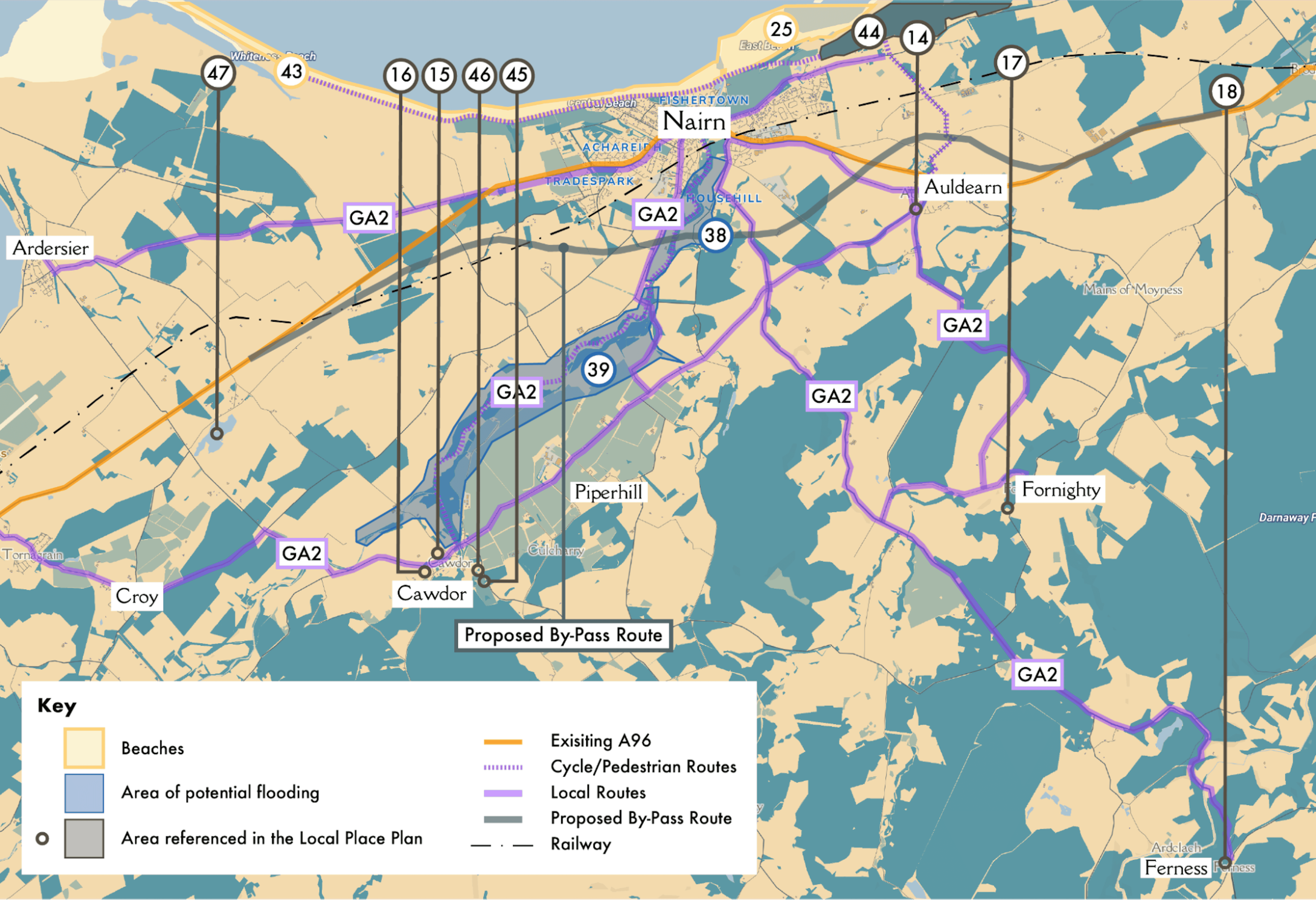
Map 2 Nairn
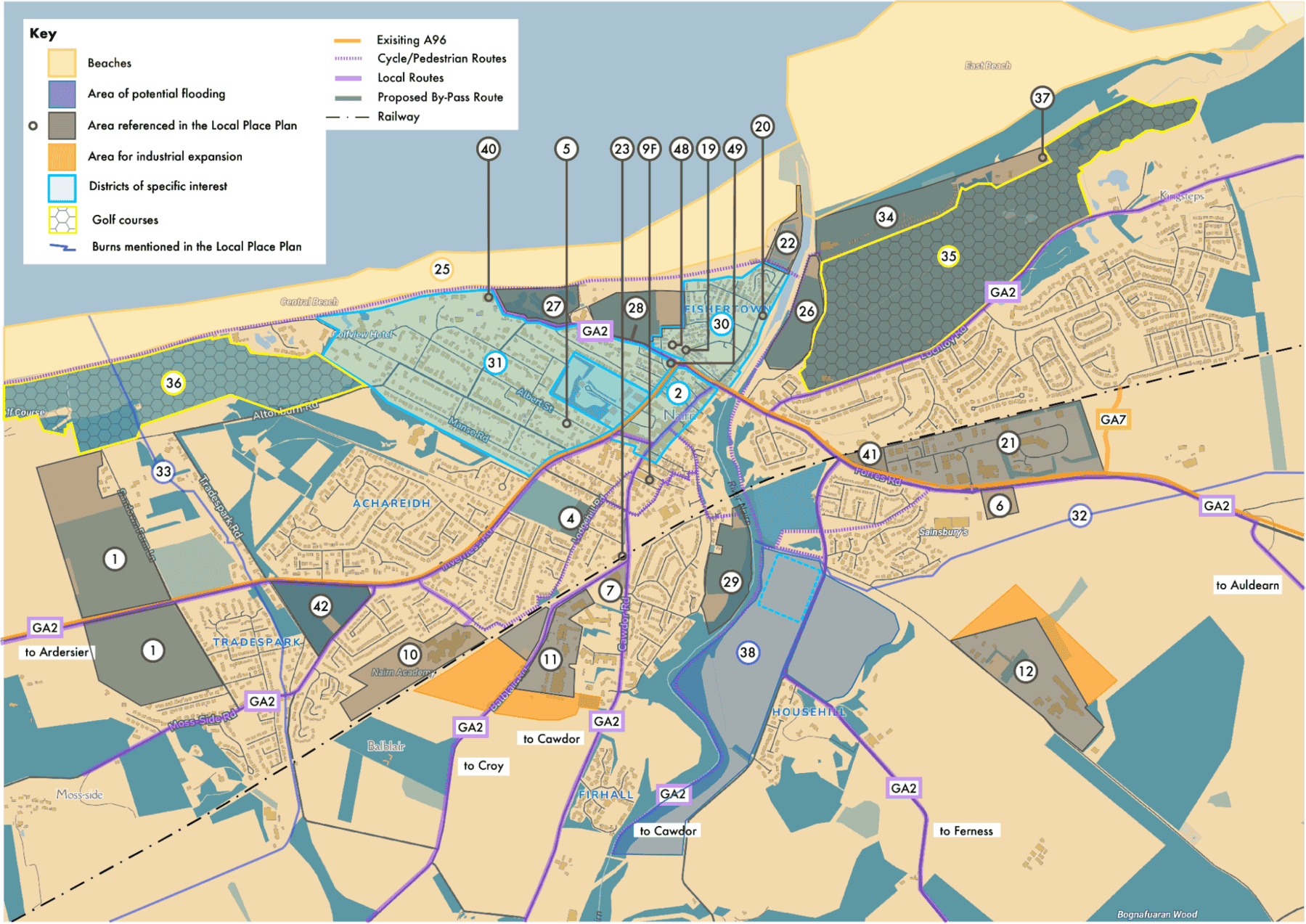
Map 3 Nairn


4.4. Sustainable Futures (SF)
The vision from the community is to create Nairn as sustainable across all it does. Creating a place that is contributing to a positive environmental future and is healthy and safe. This theme must consider how different moves within Nairn and Shire contribute to this type of future, including connections between developments, minimising unintended negative impacts, and maximising synergies where possible.
It is also about sustaining people – how a region retains a balanced population that can create a vibrant place, that provides inter-generational care and a thriving local economy with quality jobs that provide a bright future.

Description
In line with the Scottish Government’s Infrastructure First approach, all development in Nairn should be subject to this approach, requiring a robust approach to infrastructure planning and upgrades ensuring effective targeting of available resources and accessing appropriate recurrent revenue from all Highland Community Partners to match Nairn and Nairnshire’s demographic. The Nairnshire Community Partnership’s forthcoming plan will be a key document in allocating Fair Share of resources.
All new development and regeneration should improve the utility infrastructure position and not burden or create a deficit.Location
Nairnshire
SIS
n/a
Delivery Partners
SW, SEPA
Stage
Local, National
Timescale
Medium-Long Term
Supporting Policy
NPF4 Sustainable, Liveable, Productive LDP Environment, Employment, Growing Communities, Connectivity

Description
Ensure that the infrastructure to provide for highspeed broadband and mobile data connectivity across Nairn and Nairnshire is robust and available to all. This is essential for people conducting business, for future digital employment, and increasingly for people accessing essential services. Rural Nairnshire residents and businesses are a priority, due to poor or absent digital connectivity.
Location
Across Nairn and Nairnshire
SIS
N/A
Delivery Partners
OR, Scottish Government
Stage
National, Regional
Timescale
Short-Medium Term
Supporting Policy
NPF4 Liveable, Productive LDP Employment, Growing Communities, Connectivity

Description
Flooding is one of the key risks that confronts Nairn with Fishertown and the Links both very vulnerable. Areas of flood risk should be assessed as to whether it is a hard engineering protect approach, a soft engineer mitigate approach, or an adaptation approach that includes water retention in line with the Scottish Government’s Flood Resilience Strategy.
For Nairn and Nairnshire to attract national funding from the Scottish Government there needs to be Flood Risk Management studies carried out, which can then be used as evidence to lever in national funding.
New development must improve the flood map position, using the protect, mitigate, adapt system approach.
The system approach should be considered across a water catchment scale.
Location
Nairnshire
SIS
26, 27, 28, 29,30, 31, 32, 33, 34, 35, 36, 37, 38, 39
Delivery Partners
THC, Scottish Government, SEPA
Stage
National, Regional
Timescale
Medium-Long Term
Supporting Policy
NPF4 Sustainable, Liveable, Productive LDP Environment, Employment, Growing Communities, Connectivity

Description
Support the audit and consolidation of the public use of community buildings to support the viability of key community assets. There may be difficult choices about how many facilities can be sustained with current pressures on finances and institutional and community capacity. By ensuring that consolidation of uses is supported in planning terms ensures there is a route to retaining and sustaining key assets.
Location
Nairnshire
SIS
3, 8, 10, 13, 14, 15, 17, 18, 19, 20, 40, 48
Delivery Partners
THC, GH
Stage
Local
Timescale
Short-Medium Term
Supporting Policy
NPF4 Sustainable, Liveable, Productive LDP Environment, Employment, Growing Communities, Connectivity

Description
Where appropriate sites, or parts of sites are identified, support should be given to community-led energy generation schemes.
Location
Nairnshire
Delivery Partners
THC
Stage
Regional
Timescale
Ongoing
Supporting Policy
NPF4 Sustainable, Liveable, Productive LDP Environment, Employment, Growing Communities, Connectivity

Description
Support for applications for community district heating schemes should be supported. These are likely to be associated with either community energy developments, or opportunities arising through redevelopment of public assets.
Location
Nairn
SIS
3, 9B, 13, 19, 20, 40
Delivery Partners
THC, Scottish Government
Stage
Regional, National
Timescale
Long Term
Supporting Policy
NPF4 Sustainable, Liveable, Productive LDP Environment, Employment, Growing Communities, Connectivity

Description
In any proposals coming forward, whether from the local authority, community or private developer, consideration must be given to wider outcomes. Nairn has been very successful in creating an integrated approach to Health and Care, and this should include planning looking for outcomes related to:
- Education and Training
- Health and Wellbeing
- Economy and Jobs
- Environment and Sustainability.
Connections between planning and these types of outcomes can be monitored using the RPTI Measuring What Matters Toolkit.
Location
Nairnshire
Delivery Partners
DYW, SDS, THC, HIE, UHI
Stage
Regional, National
Timescale
Ongoing
Supporting Policy
NPF4 Sustainable, Liveable, Productive LDP Environment, Employment, Growing Communities, Connectivity

Description
A longer term opportunity for the future growth of Nairn, when infrastructure such as the A96 bypass, can provide the needed capacity. Development must be in the most sustainable location possible, that will have minimal impact on existing greenspaces of value.Based on proximity to the town centre and train station, plus future connections to the A96 Bypass, growth to the south is the most sustainable. Growth to either the east or west exacerbates current infrastructure deficits that communities in Nairn experience. Consideration must be given to nature, biodiversity, flood risk, connectivity and addressing infrastructure needs (without creating deficit elsewhere.)
Location
Nairn
Delivery Partners
THC
Stage
Regional
Timescale
Long Term
Supporting Policy
NPF4 Sustainable, Liveable, Productive LDP Environment, Employment, Growing Communities, Connectivity

Description
Scope to modernise the swimming pool using renewables with surplus used for district heating.
Location
Nairn Swimming Pool
SIS
40
Delivery Partners
THC, Scottish Government, Sport Scotland
Stage
Regional, National
Timescale
Medium Term
Supporting Policy
NPF4 Sustainable, Liveable, Productive LDP Environment, Employment, Growing Communities, Connectivity

4.5. Jobs and Business (JB)
There is current demand for expansion of current business, and space for new business. Community feedback, and organised groups, point out the merits of Nairn as a location for business, how it ties to the regional and national strategic direction for a green economy. Tourism is also an important part of this, from golf to green tourism, there is a lot of opportunity within Nairnshire.
Good quality jobs create an anchor for people making Nairn their home and a great place to live.

Description
Businesses in the existing industrial site have initiated a plan for the expansion of sites to accommodate future business growth and infrastructure . The Local Place Plan’s position is wholly supportive of this proposal and includes this as part of the Plan. The previously included commercial land to the Nairn East (NA05) North site is a sustainable location for expansion and contributes to Nairn as a successful place for business to locate serving, local, regional and national markets.
The Plan proposes that sustainable travel routes to the site are safeguarded on the construction of the A96 Bypass. There is also the opportunity to ensure the site is well connected to the A96 bypass, creating safe and accessible routes for heavy traffic and connecting to markets.
Location
Land to the North of the Grigorhill Business Park NA07 Land to the West of the John Gordon & Son Sawmill Balmakeith Business Park
SIS
11, 12, 21
Delivery Partners
Grigorhill Business Group, John Gordon & Son Sawmill, HIE, THC
Stage
Local
Timescale
Short-Medium Term
Supporting Policy
NPF4: Sustainable, Liveable, Productive LDP: Environment, Employment, Growing Communities, Connectivity

Description
Nairn town centre should be accommodating of a mix of commercial uses beyond retail, and food and drink. Supporting and encouraging small and sole trader businesses to locate in the town centre, including in co-working spaces, creates additional footfall, and is a sustainable and accessible location. Changes of use should be supported where it will support the aims of a regenerated and vibrant town centre. Empty buildings identified for rejuvenation and or conversion are considered in Strategically Important Sites.
Location
Nairn Town Centre referenced IMFLDP2
SIS
2
Delivery Partners
Local Property Owners, THC, HIE
Stage
Local
Timescale
Short Term
Supporting Policy
NPF4 Sustainable, Productive

Description
Support business use of office space/ co-work uses within any community hub developments.
Location
Town and village hubs across Nairnshire
SIS
13, 14, 15, 17, 18, 20
Delivery Partners
THC, HIE, The Cawdor Hub, Green Hive
Stage
Local
Timescale
Short Term
Supporting Policy
NPF4 Liveable, Productive LDP Employment, Connectivity

Description
A central location where tourism businesses can host clients, provide information, act as a meeting point and collection of rental equipment.
A Nairnshire focussed tourism strategy is needed to support this and secure Destination Management Organisation status for Nairn and Nairnshire (similar to Inverness and Loch Ness who already have access to DMO resources and information hubs.)
Location
Nairn Town Centre referenced IMFLDP2
SIS
2
Delivery Partners
HIE, THC
Stage
Local
Timescale
Short Term
Supporting Policy
NPF4 Productive LDP Employment
Description
As with JB1. The Plan adopts the proposed expansion space for the Gordon & Son Sawmill. In future, connectivity with the A96 Bypass will be critical to ensure safe and accessible routes for logistics.
Location
John Gordon & Son Sawmill, to South of Nairn IMFDLP2 Site NA07
SIS
NA07 refer IMFLDP2
Delivery Partners
John Gordon & Son Sawmill, THC, HIE
Stage
Local
Timescale
Medium
Supporting Policy
NPF4 Sustainable, Productive LDP Environment, Employment, Connectivity

Description
Support applications for changes of use or proposals that enable and develop the harbour as a place for business associated with harbour/water uses including tourism.
Location
Nairn Harbour
SIS
22
Delivery Partners
THC, HIE, BID, local businesses
Stage
Local
Timescale
Short-Medium
Supporting Policy
NPF4 Sustainable, Productive LDP Employment, Connectivity

Description
This Local Place Plan adopts the Town Centre First approach. This means that Town Centre sites should be considered for development in the first instance, with consideration also being given to the sustainable access and use of any sites brought forward that cannot be accessed. Full exploration of options and vehicles, such as all available under Community Right to Buy, to bring vacant buildings back into use, with no progress leading to compulsory purchase being sought.
Out of Town or edge of town commercial development should only be considered where it can be demonstrated that a full town centre impact assessment has been undertaken and can be demonstrated that any such development will, as a minimum, have no negative impact on footfall in the town centre.
SIS
2
Delivery Partners
THC
Stage
Local
Timescale
Short Term
Supporting Policy
NPF4 Sustainable, Productive LDP Employment, Connectivity

Description
Support the development of education/ training/ further education facilities alongside commercial development and business start-up opportunities. These are complementary uses and add value to each other.
Location
Grigorhill
SIS
12
Delivery Partners
THC, HIE, UHI, SDS, DYW
Stage
Local
Timescale
Medium-Long Term
Supporting Policy
NPF4 Productive LDP Employment

Description
To ensure that there is available short-term worker accommodation (up to 6 months), develop sites that provide for this, with high quality design, future proof for other future accommodation needs and in sustainable/ accessible locations.
Incoming employers and the public sector have a role in the first instance to invest in provision of any significant temporary workforce.
Location
Nairn Town Centre, referenced IMFLDP2 NA03
SIS
2
Delivery Partners
Local businesses, THC
Stage
Local
Timescale
Medium Term
Supporting Policy
NPF4 Sustainable, Liveable LDP Employment, Growing Communities

Description
A physical centre designed and operated around commercial and industrial innovation. Connecting to education and training, this provides an essential pathway for good quality local jobs. This centre could be located within the Grigorhill site, should a use case and demand for this type of space be proven.
Location
Grigorhill
SIS
12
Delivery Partners
THC, UHI, HIE, SDS, DYW
Stage
Local - National
Timescale
Medium – Long Term
Supporting Policy
NPF4 Productive LDP Employment

4.6. Getting Around (GA)
The A96 bypass has a very long history, and we are now at a point where it looks to be coming to reality. The implications for within Nairn are that new access and movement options open, there are great placemaking opportunities and shifting to decarbonizing internal transport. Externally, the bypass would unlock opportunities for business and homes. The case also needs to be made that the bypass plays a significant role in decarbonizing transport in the region and creating a much more liveable location.
Accessibility and connection between key assets is very important. Transport hubs, to town centre, to beach – we want to make the most of this key axis in Nairn.
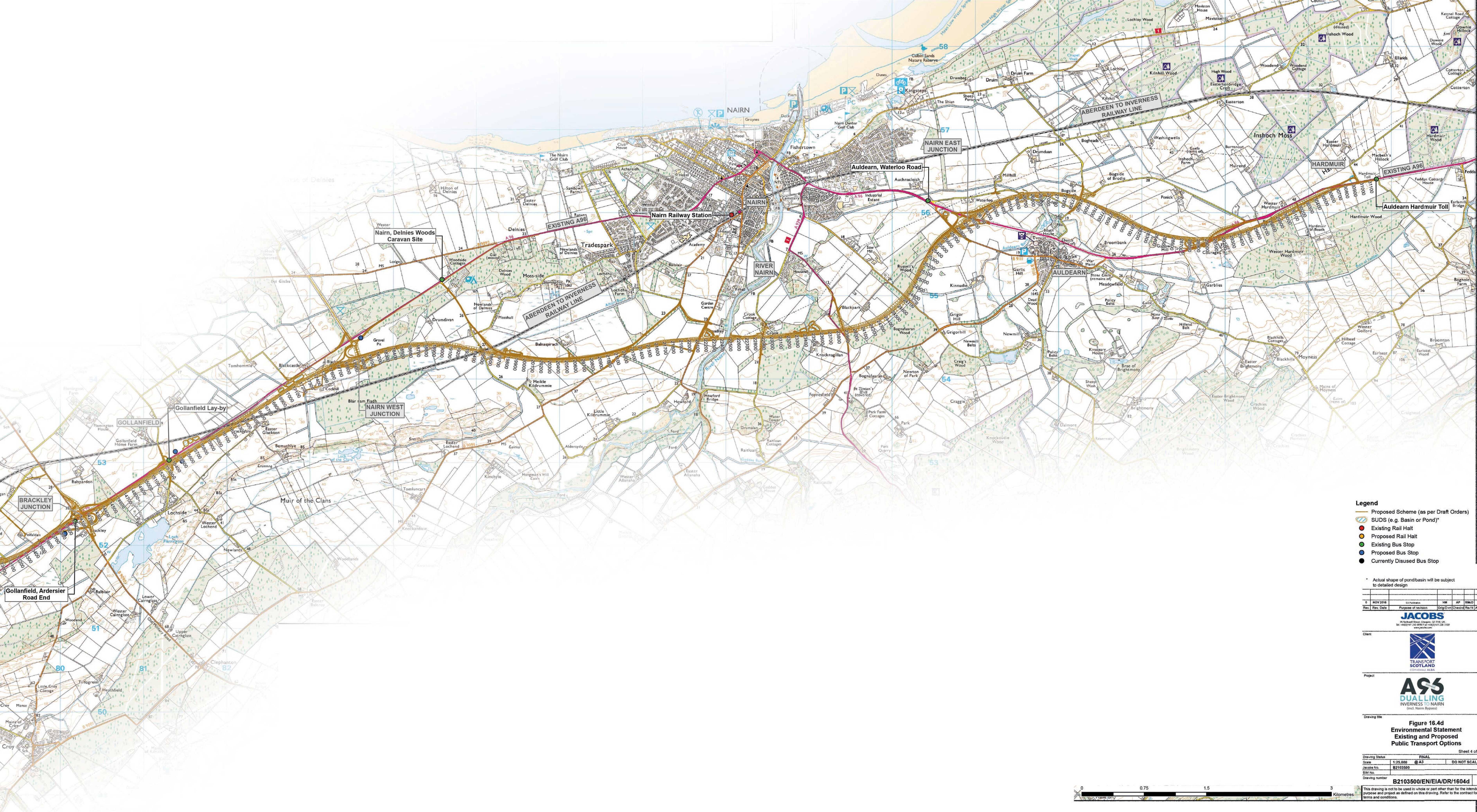


Description
The positive impact of a bypass for Nairn is apparent. Using the STAG criteria, a net positive result is shown in taking the existing trunk route out of the centre of Nairn.
The bypass route must: allow for strong road and active travel connections between Nairnshire communities and Nairn, safeguard existing connections, safeguard connections to business and education locations.
Nairn community consensus is to prioritise the Nairn A96 Bypass to tackle traffic congestion – the top issue emerging from our consultation.
Location
Nairnshire, see By-Pass Map
Delivery Partners
Scottish Government, THC, HIE
Stage
National
Timescale
Long Term
Supporting Policy
NPF4 Sustainable, Liveable, Productive LDP Environment, Employment, Growing Communities, Connectivity

Description
Nairn has some very good pathways and active travel networks. These should be mapped, formalised and extended/joined up to provide a coherent network of active travel routes, indicating the time to travel to key locations.
This must include:
- improving connections by road and active travel routes between Lochloy and the town centre
- active travel between Auldearn and Nairn, with safe crossing of the A96 (including Bypass)
- safe routes to schools.
Delivery Partners
THC, Cawdor Estate, landowners, NAP
Stage
Local, Regional, National
Timescale
Short – Medium Term
Supporting Policy
NPF4 Sustainable, Liveable, LDP Environment, Connectivity

Description
An accessible, recognisable route and signposting to link new arrivals from the Train station to the Bus Station, and vice-versa should be developed. This should be an attractive route, useable by all and include provision/space for a shuttle service between the train and bus station.
Location
Nairn Town Centre, IMFLDP2 reference NA03
SIS
23, 24
Delivery Partners
THC, NAP
Stage
Local
Timescale
Short Term
Supporting Policy
NPF4 Sustainable, Liveable LDP Environment, Connectivity

Description
An accessible and recognisable route that connects from the key travel node to the town centre and to the beach. Connecting these key assets together is necessary for supporting the tourist/day visitor experience and creating a liveable Nairn.
Tourist information, bike hire, bike taxis etc are also suggested as ways of making connections between the Railway and Bus Stations, to link visitors and locals to town centre, seaside and other local amenities.
Location
Nairn Town Centre, IMFLDP2 reference NA03
SIS
2, 23, 24, 25, 27, 28, 34
Delivery Partners
THC, NAP
Stage
Local
Timescale
Short Term
Supporting Policy
NPF4 Sustainable, Liveable, Productive LDP Environment, Employment, Growing Communities, Connectivity

Description
As per GA1 for the A96 development. Any other new development must take into consideration any routes and safeguard these for future use. Developments should contribute to the improvement and maintenance of routes.
Location
Nairnshire
Delivery Partners
THC, Scottish Government
Stage
National
Timescale
Long Term
Supporting Policy
NPF4 Sustainable, Liveable, Productive LDP Environment, Employment, Connectivity

Description
Traffic calming and active travel developments for villages go hand in hand to ensure that active travel is a viable and attractive option.
Safe joined up active travel routes are needed between all Nairnshire settlements to link Croy, Cawdor, Auldearn and Ferness to Nairn.
Location
Nairnshire
Delivery Partners
THC, Land Owners
Stage
Local
Timescale
Short-Medium Term
Supporting Policy
NPF4 Liveable LDP Environment, Connectivity

Description
Creating a direct travel link between Lochloy and Balmakeith supports the creation of a full active travel network between Lochloy and key destinations, including:
- Auldearn and Auldearn Primary School
- Nairn retail park
- Nairn town centre
- Nairn primary and secondary schools.
The 2021 consultation by NRCC identified that historically, an active travel or pedestrian route over the railway between Lochloy and Balmakeith was not the preferred solution for current community needs. The community needs a second access road to Lochloy, linking residents to nearby shops and schools and reducing the traffic bottleneck at Merryton A96 Junction. The community preference was for a road connection from Lochloy to the East of Nairn linking to the A96. See Appendix Lochloy Active Travel Bridge Community Survey 2021.
Location
Lochloy and Balmakeith
Delivery Partners
THC, NAP, NR
Stage
Local, Regional
Timescale
Short-Medium Term
Supporting Policy
NPF4 Sustainable, Liveable, Productive LDP Environment, Connectivity

4.7. Town and Village Centres (TV)
Revitalising Nairn town centre is a high priority for the community within the town and region. As a centre for living, jobs, leisure and culture, this is a remaking of the town centre as a well-used, liveable and investable place.
Village and local hubs play a role in creating liveable places, providing people with their daily needs, and through connections, meeting all needs regionally. Key life outcomes such as health, community wealth and a sustainable environment are dependent on creating these types of places.

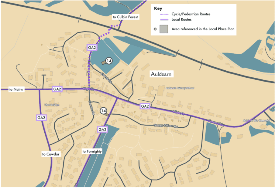
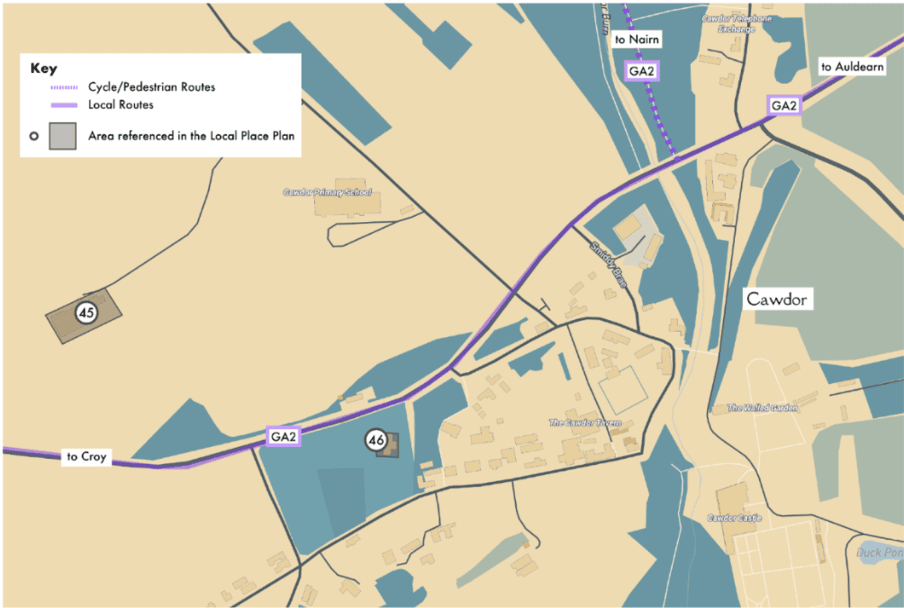

Description
As the most sustainable location in Nairn, the town centre is an ideal location for regeneration to meet the demand for 1 and 2 bed homes. There should be a mix of tenures, with a preference for social housing. This could be achieved through conversion of empty buildings, flat above shops and redevelopment of key town centre sites.
It should be noted that the community preference for future development before completion of the A96 By-Pass is a mix of only small, sympathetic development which are complementary to existing towns and villages paired with regeneration of the existing built environment.Location
Nairn Town Centre, IMFLDP2 reference NA03, various throughout Nairnshire
SIS
2
Delivery Partners
THC, Property Owners, Developers
Stage
Local
Timescale
Short-Medium-Long Term
Supporting Policy
NPF4 Sustainable, Liveable, Productive
LDP Environment, Employment, Growing Communities, Connectivity

Description
Greenspaces provide important utility for a town including for health and wellbeing, environmental adaptation and creating an attractive place. The identified sites must be protected from (over) development, have improved accessibility and legibility, analysis for enhancements (including public toilets, play equipment etc).
Consideration must also be given to assess green spaces for suitability for protection from flood risk, or use as river flood water attenuation.
Location
Viewfield Park Former Showfield Riverside (Jubilee Bridge to Whinnieknowe) The Links Nairn County FC
Location
Nairn, various
SIS
3, 4, 22, 25, 27, 28, 29
Delivery Partners
THC, Scottish Government
Stage
Local, National
Timescale
Medium-Long Term
Supporting Policy
NPF4 Sustainable, Liveable, Productive
LDP Environment, Employment, Growing Communities, Connectivity

Description
Coordination of various uses within single buildings provides communities with a viable approach to providing needed facilities and services. Safeguard village hub buildings/sites for community use.
Potential buildings include: Lethen Hall and Church (Auldearn), Fornighty Hall, Cawdor Community Hub/Primary School.
These could include space for events, weekly uses, coworking, pop-up shop/cafes etc.
Location
Auldearn, Fornighty, Cawdor, Ferness, Nairn
SIS
13, 14, 15, 17, 18, 19, 20, 48
Delivery Partners
HIE, THC
Stage
Local
Timescale
Medium Term
Supporting Policy
NPF4 Sustainable, Liveable, Productive
LDP Environment, Employment, Growing Communities, Connectivity

Description
Nairn’s Fishertown was designated as a Conservation Area in 1979 (CON10). The production of an appraisal and management plan is overdue.
This process would allow for the opportunity to review and update the boundaries of the Conservation Area. The Plan process suggests that the wider Victorian Spa Town area could benefit from Conservation Area Status. This would allow additional funding to be sought, which could be a catalyst for town centre regeneration.
The priority is therefore to undertake the review of the Conservation Area Appraisal and Management Plan to begin the process of exploring this opportunity.
Location
Nairn Fishertown
SIS
30, 31
Delivery Partners
THC, HES
Stage
Local, National
Timescale
Medium Term
Supporting Policy
NPF4 Sustainable, Liveable, Productive
LDP Environment, Employment, Growing Communities, Connectivity

Description
Post A96 bypass, de-trunking of Academy Street, King Street and St Ninian Road will be a priority.
De-trunking must give space for Active Travel, better connectivity and signposting for routes across King Street, identify opportunities for public spaces and other uses that would not be compatible while King Street is a trunk road.
This process should be done alongside a full traffic management strategy for Nairn.
Location
Nairn
SIS
2, 3, 9A, 9E
Delivery Partners
THC, NAP
Stage
Local
Timescale
Long Term
Supporting Policy
NPF4 Sustainable, Liveable, Productive
LDP Environment, Employment, Growing Communities, Connectivity

Description
Strategic sites for housing include East of Retail (NA06), Albert Street Bowling Green site and other Town Centre (NA03) redevelopment sites. Again, this housing should be developed to meet proven demand and aimed at reducing pressure on housing lists, tourist accommodation and other scenarios.
Identified sites for any new development should be developed in accordance with community design guides for said sites.
Location
Nairn
SIS
2, 4, 5, 6, 9D
Delivery Partners
THC, Land Owners, Developers
Stage
Local
Timescale
Medium-Long Term
Supporting Policy
NPF4 Sustainable, Liveable, Productive
LDP Environment, Employment, Growing Communities, Connectivity

Description
Community-led design guides should be prepared for:
- East of Retail (NA06)
- Town Centre (NA03)
- Former Showfield (NA02)
- any future housing development at Albert Street Bowling Club
- future sites could be added to this list.
Future sites could be added to this list.
The design guide would include design approaches, housing types, sustainability and biodiversity approaches, connectivity and site uses.
Location
Nairnshire
SIS
2, 4, 5, 6
Delivery Partners
THC
Stage
Regional
Timescale
Short Term
Supporting Policy
NPF4 Sustainable, Liveable, Productive
LDP Environment, Employment, Growing Communities, Connectivity

4.8. Green Space and Leisure (GSL)
The community consultation has highlighted time and again that the natural environment is Nairn and Nairnshire’s greatest asset in terms of value to those who live here both old and young. For tourism, health and wellbeing, sport, and leisure, the community wants their green spaces to be protected and enhanced for future generations. From mountains to forests to coast, there is a wealth that can be maximised for future green business, tourism, quality of life and environmental sustainability.


Description
Within the Royal Burgh of Nairn, the Common Good land provides much of the key greenspace. Careful stewardship is required to ensure that this continues to work for the people of Nairn, providing greenspace and natural environments, climate adaptation and mitigation opportunities, and where appropriate, development that provides a long-term good.
In addition to the Town Centre spaces identified in TV3, these spaces should be safeguarded and conserved for greenspace and leisure use.
Location
The Maggot, Sandown Allotments, Former Morganti land, Viewfield, Tradespark Woods and playpark, Nairn Riverside
SIS
1, 3, 4, 22, 27, 28, 29, 41, 42
Delivery Partners
THC
Stage
Local, Regional
Timescale
Short Term
Supporting Policy
NPF4 Sustainable, Liveable, Productive
LDP Environment, Employment, Growing Communities, Connectivity

Description
Coastal protection should be brought forward in a way that best protects these assets, while not creating negative impacts in other locations.
Re-development of the old paddling pool into the Team Hamish Splash Pad was opened by HRH Camilla on 10th September 2021.. Team Hamish are now taking forward with THC a re-development proposal for the existing mini and crazy-golf courses, outdoor board games and West Links area which is fully supported by this LPP.
Coastal protection should be brought forward in a way that best protects these assets, while not creating negative impacts in other locations.
The rock armour between the Leisure Centre and the groyne protects the Links footpath but this sea defence is in need of urgent repair and strengthening. Options for repair are being considered and alternatives for the path may need to be looked at. The sand dunes of Nairn central beach protect the rest of the Links. The findings and recommendations of the JBA Consulting report ‘Dynamic Adaptive Pathways’should be considered, by the community, as a means of building the resilience of the dune system that protects the Links
Location
Nairn Beach
SIS
22, 25, 26, 27, 28, 31, 35, 43,
Delivery Partners
THC
Stage
Local, Regional
Timescale
Short-Medium Term
Supporting Policy
NPF4 Sustainable, Liveable, Productive LDP Environment, Employment, Growing Communities, Connectivity

Description
Safeguarding and promoting key tourist and resident Links and beach front assets for Nairn and Nairnshire. Sensitive development of facilities to promote use of the Links and Beaches should be carefully considered in terms of design, siting, sustainability and viability.
Re-development of the old paddling pool into the Team Hamish Splash Pad was opened by HRH Camilla on 10th September 2021.
The future Team Hamish re-development proposal for the existing mini and crazy-golf courses, outdoor board games and West Links area are fully supported by this Plan in partnership with THC.
Location
Nairn Links
SIS
22, 25, 27, 28, 34, 35
Delivery Partners
NICE, TH, THC
Stage
Local
Timescale
Short-Medium Term
Supporting Policy
NPF4 Sustainable, Liveable, Productive
Description
Safeguarding woodland (planted or naturally regenerating) spaces for appropriate uses.
Other uses suggested for areas of woodland – Tradespark and Culbin - include tree top trails.
The Former ‘Morganti Land’ site is promoted by the NRCC for a Community Right to Buy application.
Location
Former ‘Morganti Land’, Tradespark Woods, Culbin Woods
SIS
42, 44, 41
Delivery Partners
THC, NRCC
Stage
Local, Regional
Timescale
Short Term
Supporting Policy
NPF4 Sustainable, Liveable, Productive
LDP Environment, Employment, Growing Communities, Connectivity

Description
Part of Nairn’s Common Good, the land should be developed only in a manner that maximises the benefit to Nairn. Current uses to be explored for the south side include:
- A Wetlands Education Centre Community Greenspace, Sustainable energy generation, and some community-led development
For north of the A96:
- Sports facilities
A process for taking this forward should include a community-led action plan process and site viability. This to include the input of the CGRP.
The NSWCC position on any housing development is that the very strong community view is that no housing should be developed on Sandown.
Location
Sandown
SIS
1
Delivery Partners
THC
Stage
Local, Regional
Timescale
Ongoing
Supporting Policy
NPF4 Sustainable, Liveable, Productive
LDP Environment, Employment, Growing Communities, Connectivity

Description
Applications to develop supporting kit for the use of identified greenspaces should be supported where the proposed kit is of high quality and contextual design, sustainable in approach and with a viable maintenance plan. Equipment includes the likes of: benches; bins; public toilets; play equipment, etc.
Location
Nairnshire
SIS
22, 25, 26, 27, 28, 29, 34, 38, 42, 43, 44
Delivery Partners
NICE, THC
Stage
Local
Timescale
Short Term
Supporting Policy
NPF4 Sustainable, Liveable, Productive
LDP Environment, Employment, Growing Communities, Connectivity

Description
Development of a pump track to replace the BMX track at Riverside. The study, under development at the time of preparing the Local Place Plan, proposed this work demonstrates that the maintenance burden of the pump track is minimal compared to the BMX track. Associated kit to support use of the space.
Due to Riverside flood risk, this project needs to be tied in to any Flood Management Plan and could be part of a wider Community Action Plan for Riverside/Mill Road/Queens Park area.
Location
Riverside
SIS
29
Delivery Partners
THC
Stage
Local
Timescale
Short Term
Supporting Policy
NPF4 Sustainable, Liveable, Productive LDP Environment, Employment, Growing Communities, Connectivity

Description
All new development must improve the nature and biodiversity position of the development site. If there is to be a % for nature approach established through planning conditions, where developers make a contribution to an established fund for making nature and biodiversity improvements throughout Nairn, including retrofitting, this fund should be controlled by the community to meet needs identified in this Plan or any other community led CAPs flowing from it.
Location
Nairnshire
Delivery Partner
THC
Stage
Local
Timescale
Short Term
Supporting Policy
NPF4 Sustainable, Liveable, Productive
LDP Environment, Employment, Growing Communities, Connectivity

Description
Golf is an important part of Nairn’s heritage, economy, and sporting culture with potential for expansion. Golf courses should be safeguarded from development and appropriate works that protect from flooding should be supported, provided these works do not make the issue worse elsewhere.
In the future it may be necessary for golf courses to move parts of their courses if it is not environmentally or economically viable to protect or retain coastal sections. Land should be identified and safeguarded for these future changes.
Location
Nairn Dunbar Golf Club, Nairn Golf Club, Cawdor Castle
SIS
35, 36, 45
Delivery Partners
Nairn Dunbar Golf Club, Nairn Golf Club, Cawdor Castle Pitch & Putt, THC, Sport Scotland
Stage
Local, Regional
Timescale
Short-Medium Term
Supporting Policy
NPF4 Sustainable, Liveable, Productive
LDP Environment, Employment, Growing Communities, Connectivity
Description
As part of the system approach to water and flooding, work to enhance and restore this Loch and water catchment area. This should perform an important function in terms of natural habitat, biodiversity and water catchment scale mitigation for water retention in the area.
Location
Loch Flemington
SIS
4
Delivery Partners
UK Centre for Ecology & Hydrology, THC, SG
Stage
Local-Regional-National
Timescale
Ongoing
Supporting Policy
NPF4 Sustainable, Liveable, Productive
LDP Environment, Employment, Growing Communities, Connectivity
Appendices
What the Local Place Plan means for Nairn and Nairnshire:
Community-Led Planning for a Thriving Future
The opportunity to present a set of well-researched, well-constructed proposals, developed through community engagement, is a powerful and transformative moment for Nairn and Nairnshire. This process allows our community to articulate our vision for the future, expressing how we want our home to look and feel, what it can offer to current and future generations, and the values that underpin our way of life.
Our Nairnshire Local Place Plan is a document that is both a submission to Highland Council for consideration as they prepare the next Highland Local Development Plan, and it is an expression of our community vision, setting out our priorities for how Nairn and Nairnshire should develop over the next 5-10 years. The steps we take and successes we make in delivering the Plan will set the agenda for the next 5-10 years.
We have prepared this Local Place Plan in line with the legislation and with Planning Circular 1/2022. The plan takes into consideration National Planning Framework 4 (‘NPF4’), the Highland Wide Local Development Plan, and the Inner Moray Firth Local Development Plan 2. We have considered how our proposals for the use of land and buildings generally align with relevant policies and themes from these documents. We have also considered how we are connecting to Scotland’s National Performance Framework, with its focus on outcomes and the UN’s Sustainable Development Goals.
Aligning with National Planning Framework 4 (NPF4)
As national planning initiatives set the stage for a series of ambitious outcomes, local communities have the chance to create plans that align with these broader goals. The Nairn and Nairnshire plan has been crafted with careful consideration of NPF4, incorporating its vision, themes, and policies. Throughout the preparation of this plan, we have benchmarked our aspirations against NPF4’s criteria to ensure alignment and relevance.
Community Engagement and the Criteria of a Successful Place
During workshops held in May, we utilised the NPF4 Six Qualities of Successful Places to review our proposals. It quickly became evident that these criteria should serve as a benchmark for how change and preservation are managed in Nairn.
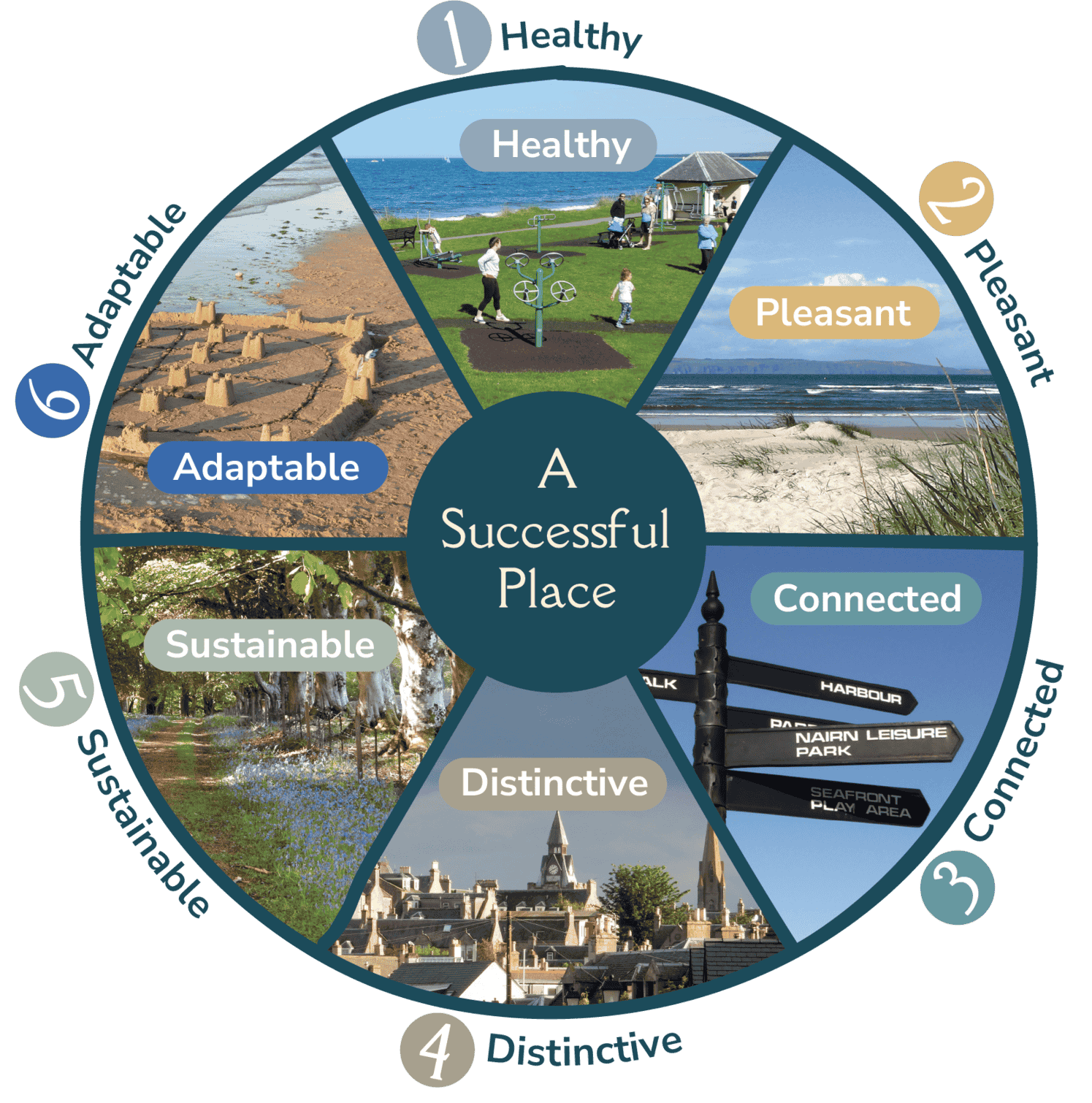
The plan has been led by a dedicated Steering Group, including Directors of NICE, Nairn BID, and representatives from Nairn and Nairnshire’s Community Councils. Through extensive engagement with diverse groups and the wider community, we have developed a plan that best represents the interests and aspirations of all of Nairn and Nairnshire.
5.1. The Background to Our Vision
Where we are starting from
- Strengthening collaboration, trust and joined up working between Nairnshire communities, including our business community, public authorities including Highland Council, and its other community partners e.g. NHS Highland, Highlands and Islands Enterprise
- Building common community direction and momentum
- Setting out a 21st century proposition for Nairn as a sustainable market town, serving Nairnshire and the wider region.
What are the challenges that the Local Place Plan needs to respond to
- changing demographics – an ageing population;
- changing housing needs – new patterns of household formation and shortage of affordable private and social rented housing to meet longstanding and new local needs
- addressing the challenges of the nature and climate emergency
- competition from other places – creating an attractive place for tourism, business and living
- delivery – in a climate of reducing public budgets, new methods of delivering or creating the conditions for investment may be required, and improved targeting of funds from a range of sources to give greater value for money is essential
- an infrastructure deficit – while any new development would address its own infrastructure needs, there is a priority need to redress infrastructure deficits left by previous periods of growth in Nairnshire e.g. roads, sewerage, flood defences, community amenities (including schools and health.)
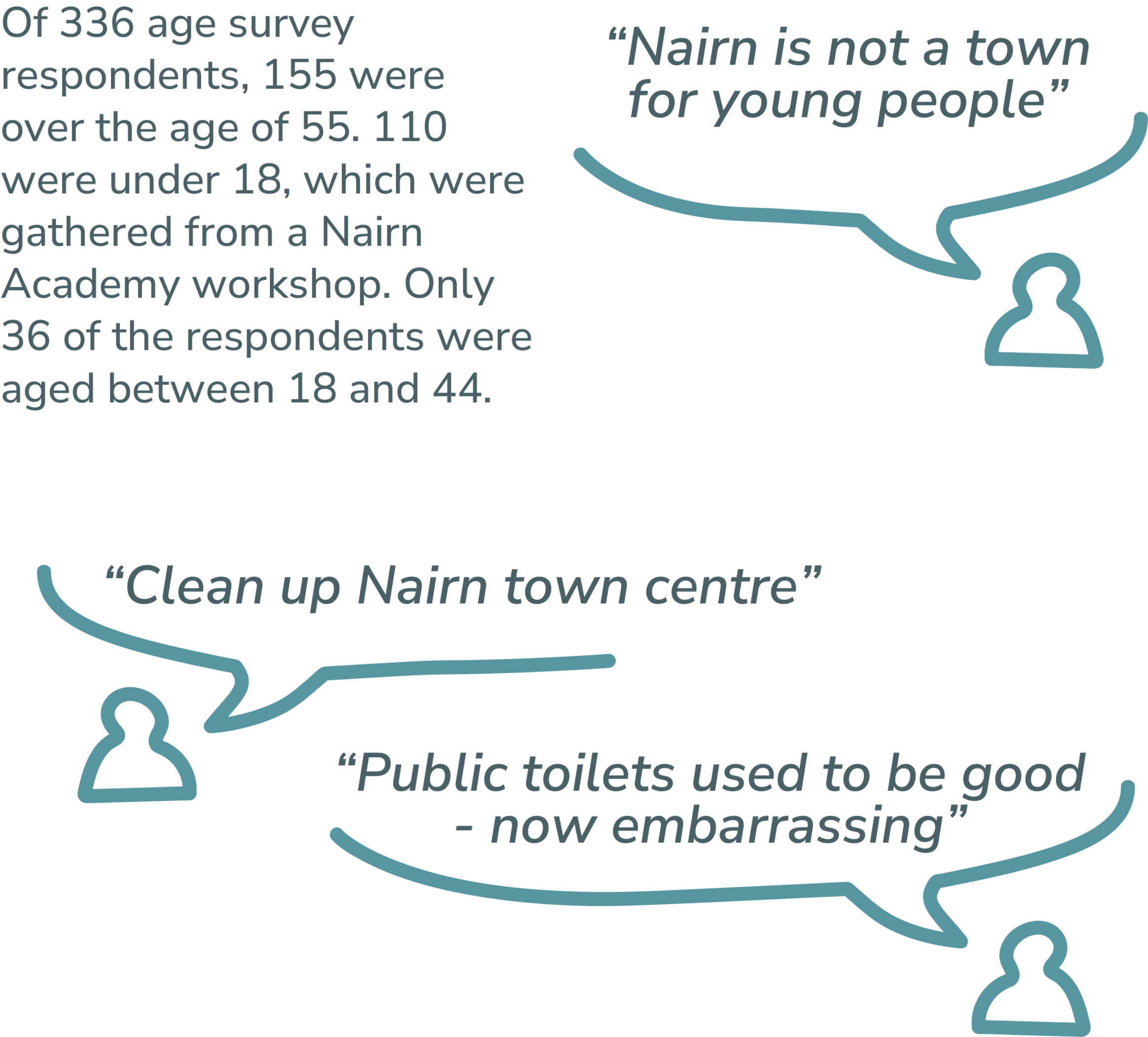
Integrating the best of practice in Nairnshire with Place
Nairn, Nairnshire and its community are not new to planning and delivering. There is a strong history of successful advocacy, fundraising and project development. A coordinated approach can further channel this talent and legacy to help overcome a challenging delivery landscape.
Health and Social Care is an area in which Nairn Healthcare multi agency delivery hub, based at Nairn Town and County Hospital has recently been held up as a National Standard/model of best practice. Integration of these lessons into other areas such as education and training, environment, economic growth and stewarding a population, creates opportunities for a constructive place-based approach.

What is the plan supposed to do
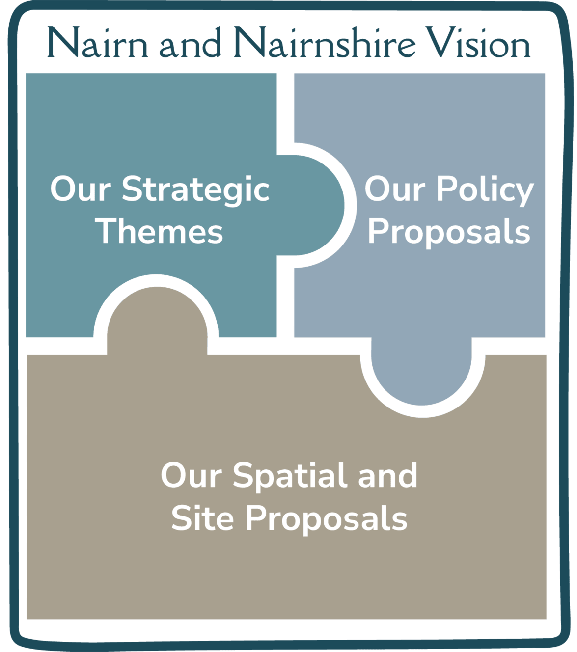
preserve, protect and enhance
partner our community with public services to deliver
identify local needs
create new opportunities
As a Local Place Plan, the focus is on the protection and preservation, changes and use of land and buildings. It differs from a Community Action Plan in that its purpose is to input directly into the next Highland-wide Local Development Plan. This plan seeks to create the spatial structure and strategy for delivering the conditions for the Nairn that the community wants to see. As such, proposals are primarily about setting the land use, and not always providing the detail and specification of what the final use may be. This is reserved for community action planning coming forward from both the wider Nairn communities and the Nairn and Nairnshire Community Partnership.
The document does have another purpose, that of advocacy. We will use the document to demonstrate to delivery bodies and partners what we see as the priority needs for Nairn and Nairnshire. There needs to be a joined up approach to delivery from all partners in Nairn and Nairnshire, ensuring that any change does not come at a cost, but improves the situation. For example, any new development needs to improve the position on sewerage and waste water, this would require a joined up approach between the developer, Scottish Water, Highland Council and community representatives. This plan can be used to coordinate that approach.
5.2. How We Prepared the Plan
Engaging the community of Nairn and Nairnshire has been a cornerstone of this planning process. The Steering Group and their team have dedicated significant effort to ensure broad awareness and participation. Their strategies included area-wide mailings, surveys, a community roadshow, stakeholder meetings, and specialised workshops for community organisations and schools. This extensive engagement has been designed to gather input and reflect the community’s aspirations in the Local Place Plan.
The Engagement Process
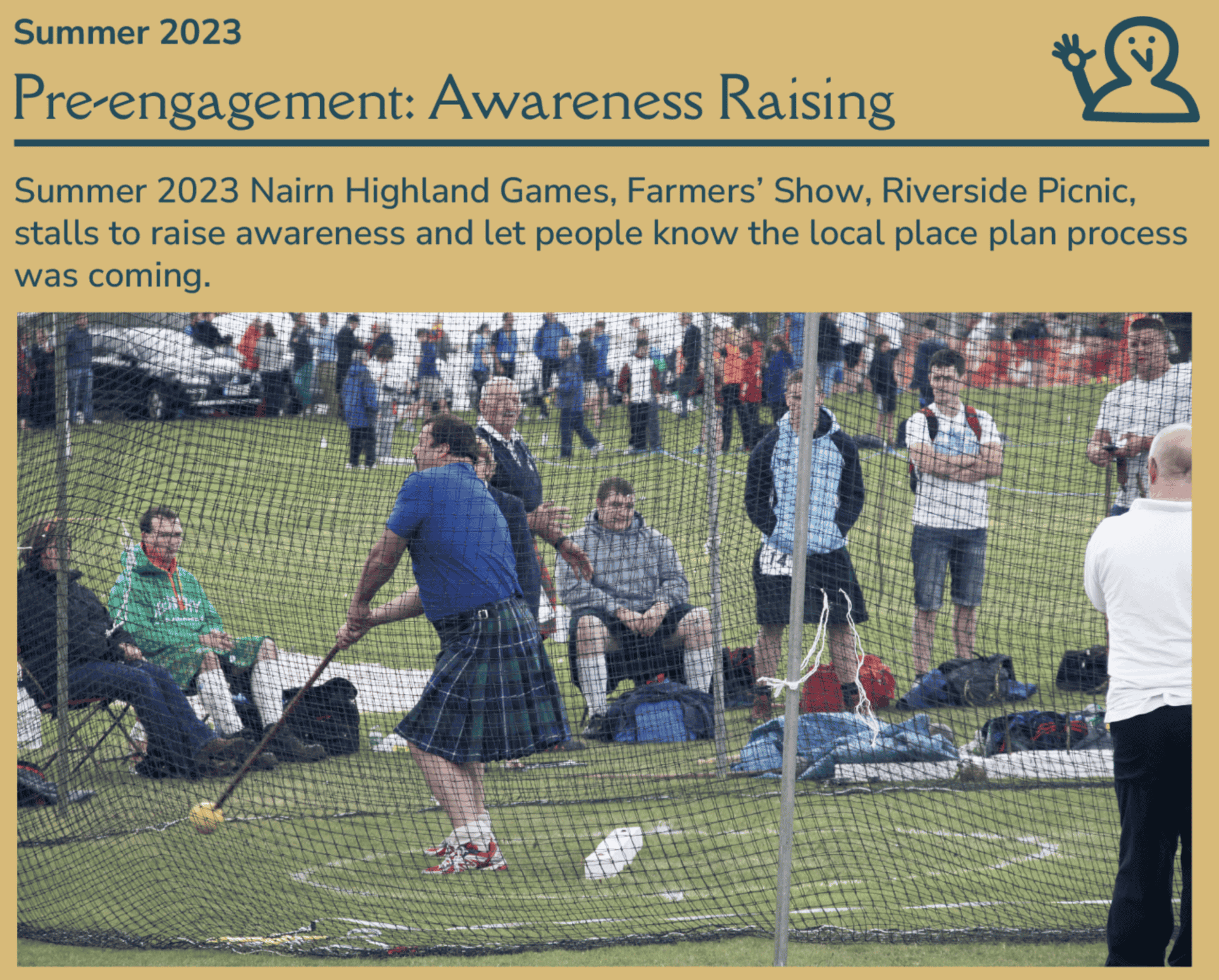
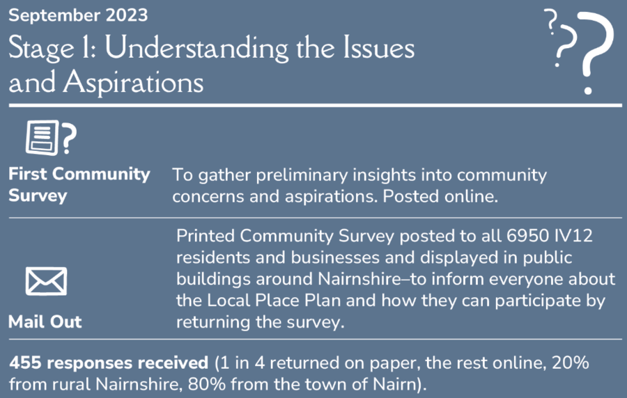
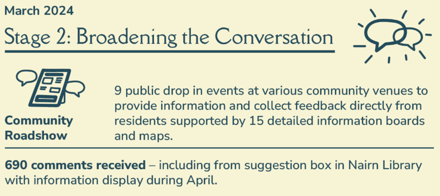


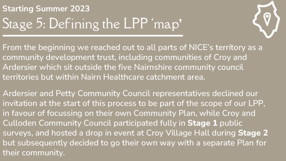
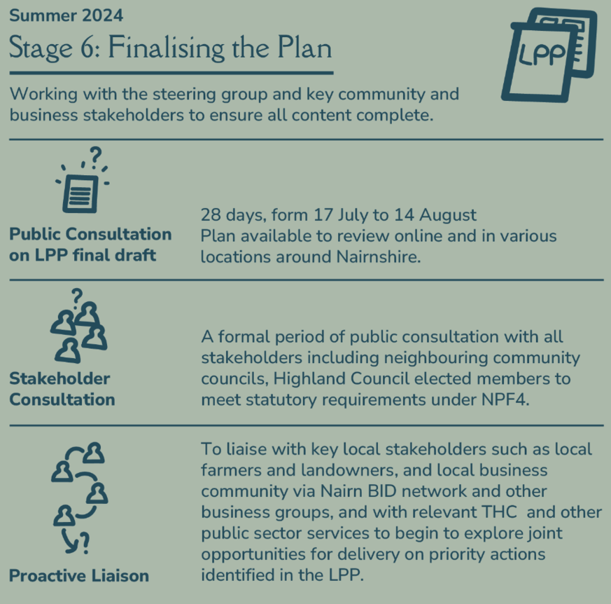

Detailed Workshop Insights
Under each key theme, workshops were facilitated independently by Planning Aid Scotland to explore around 20 specific projects and idea cards identified by PAS from the community content gathered during Stages 1 and 2.
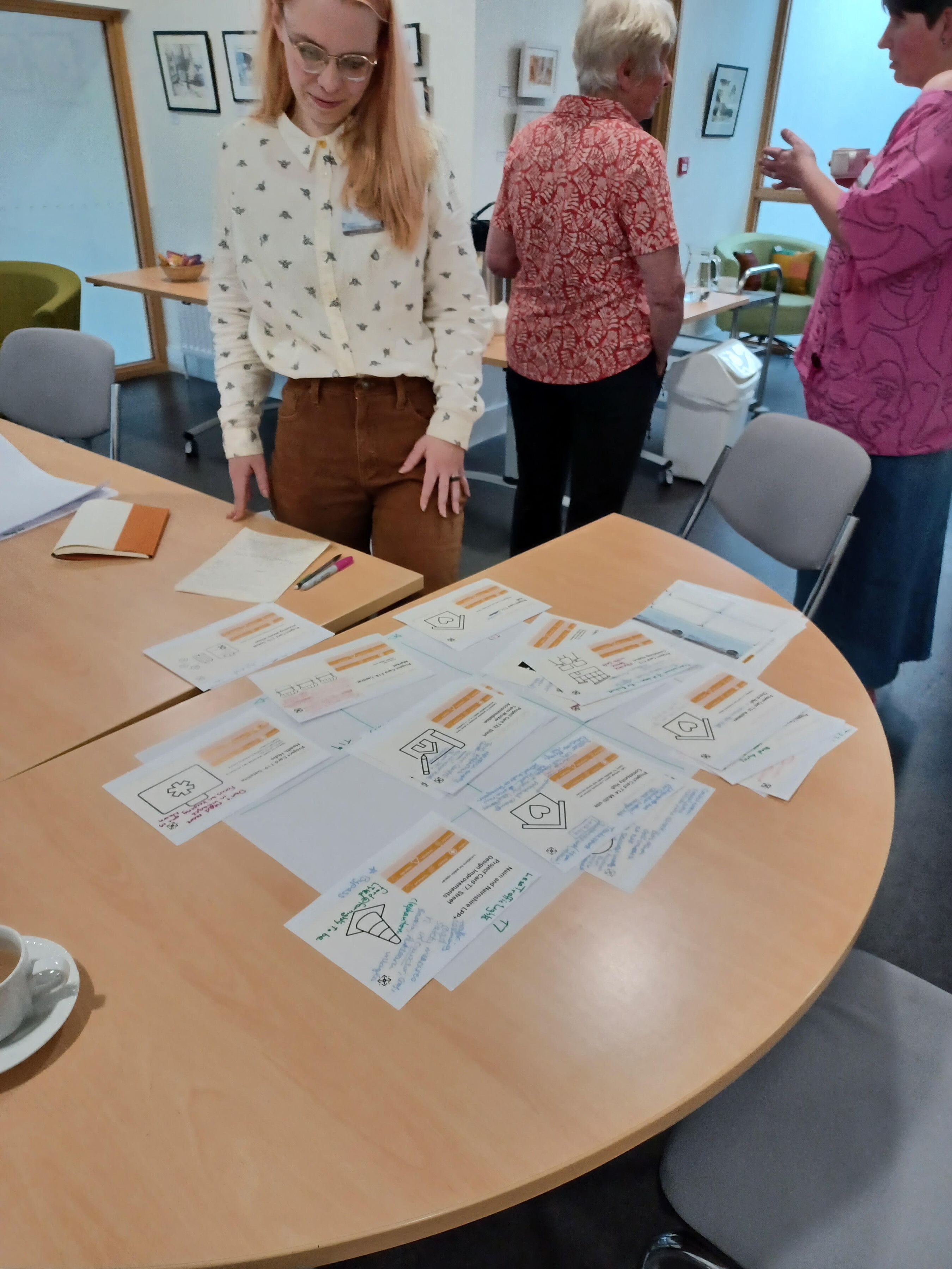
This collaborative process aimed to:
Identify Locations and Spatial Elements Determine the best locations for proposed projects and the spatial requirements.
Identify where this sits with Community Action Plans Ensure that projects are in harmony with existing community action plans and activities, and/or flag that they would be better located in a future community action plan rather than a spatial Local Place Plan
Determine Delivery Prerequisites
Identify the necessary resources, partnerships, and steps required for successful implementation.
The engagement process has been comprehensive and inclusive, ensuring that the Local Place Plan is truly reflective of the community’s needs and aspirations. Through careful planning and widespread participation, the community of Nairn and Nairnshire has played a pivotal role in shaping a future that aligns with their vision and values.
Appendices
6.1. Collaborative Implementation Framework:
In June 2023, the Nairn Improvement Community Enterprise (‘NICE’) was charged with preparing the Plan. NICE, as a properly formed community enterprise, is well positioned to lead the delivery of the Plan.
In delivering the Plan, NICE will:
- form a delivery group to champion delivery of the Plan, comprising key community stakeholders including business leaders who bring local knowledge and experience to the table, with public sector representatives to help unlock resources of key partner agencies, investors and funders to enable delivery
- prepare a Local Place Plan Delivery Plan, to set out the local outcomes and projects which, when delivered, will achieve the strategic outcomes of the Plan
-
employ a Development Officer, who will coordinate sub groups to take forward priority actions to deliver key Plan actions, including the likes of:
- developing individual plans and strategies for key themes eg climate resilience, tourism strategy, local transport, active travel plan, etc
- business and jobs growth
- town centre audit and plan
- heritage and conservation
- lead the delivery of the Plan, create the Community Action Plan, and lead the integration of the community, business, public, and third sectors
- conduct training sessions and workshops to build capacity within the community, enabling effective participation and ensuring that local initiatives have the support they need to succeed
- maintain transparent and regular communication channels among all partners through meetings, newsletters, and online platforms
- organise periodic community forums and feedback sessions to update stakeholders on progress, address concerns
- adapt the plan as needed based on collaborative input and changing circumstances
To be effective and sustainable, future regeneration and development projects must include community leadership, working in collaboration with key partners including The Highland Council, public agencies including the NHS and Highlands and Islands Enterprise, property owners and developers, and local businesses. Community led developments may be supported by a mix of public funding, private investment, and community ‘crowdsourcing’. The role of the Development Officer is absolutely critical to ensure effective, efficient and progressive delivery.
Working together in a coordinated and structured way will enable our community bodies, local authority, public agencies, and the business sector to work together effectively to leverage resources, local knowledge, and experience to create a green and sustainable Nairnshire.
This integrated, partnership approach to Nairnshire’s development will be needed, which should consider health, social and economic impacts of spatial, land use, and physical developments. Team Hamish success is a great example of the capability within our community. Preparation of this Plan is a testament to what can be achieved when we work together – a funded, delivered, community led development plan for the future of Nairnshire.
Not all things local people have asked for in our consultation were about physical planning but about the activities and services including social, cultural, educational, heritage and health care which happen in buildings and throughout the community.
We hope this Nairnshire Local Place Plan will provide a strong foundation and information resource to help local community interest groups present evidence for future funding bids and even to develop their own Community Action Plans to meet local needs in specific neighbourhoods.
NICE welcomes the commitment already offered by the Nairnshire Community Partnership over the past year to help deliver on local community priorities as we move forward together.
There are big challenges ahead for Nairnshire but developing this Plan has confirmed how resourceful and passionate our local community is to get things right for this place.
Resources
NICE, in pursuing the delivery of this Plan, will collaborate with key community bodies across Nairnshire, including:
- Nairn BID board, membership, and other local business leaders
- community councils
- Green Hive and community hubs from across Nairnshire
- community bodies and interest groups referenced in the Plan
- business and third sector
- public bodies
To ensure best value is achieved at all times, resources may be shared amongst the key Nairnshire community bodies to ensure timely delivery, transparent reporting, collaborative outcomes, and capacity to deliver.
Communications and Engagement
The Plan has been established, in its first format, as an online hybrid document, presented as a web-site. The second format is a PDF printable format, presented as a traditional document. The focus will remain on digital and online communications. The domain ournairnshire.org will, following adoption of the Plan, be developed to include additional content:
- Nairnshire news and activities
- the Community Action Plan
- schedule and diary of public meetings and forums
- live projects, including plans, status updates and progress reports
- budgetary reports
Ensuring clear and effective communications and engagement will be led by the Development Officer.
6.2. Actors identified
Delivery of what is contained in this plan is not the responsibility of any single group, but is spread from national to grass roots. To continue as the Plan process has started, this means working across all levels to move Nairn forward in partnership.
The below table sets out some of the delivery partners who will be sought out. This list will evolve over time as delivery becomes clearer. Relevant Plan Themes are coded as:
Sustainable Futures (SF)
Jobs and business (JB)
Getting Around (GA)
Town and Village Centres (TV)
Green Space and Leisure (GSL)
Projects: A96
Relevant Plan Themes: GA
Projects: Economic Development, Housing, A96 de-trunking, roads improvements
Relevant Plan Themes: SF, JB, GA, TV, GSL
Projects: Flooding
Relevant Plan Themes: SF
Projects: Conservation Areas, Heritage
Relevant Plan Themes: SF, TV, GSL
Projects: Local Nature Reserves
Relevant Plan Themes: SL, GSL
Projects: Active travel, placemaking
Relevant Plan Themes: SL, GA, TV, GSL
Projects: Social housing delivery
Relevant Plan Themes: SF, JB, TV
Projects: Support with community-led delivery, asset transfers etc
Relevant Plan Themes: SF, TV, GSL
Projects: Economic development, business-led developments
Relevant Plan Themes: SF, JB, TV
Projects: Currently operates Nairn Swimming Pool, a leisure facility at Nairn Academy and maintains Nairn Splashpad at Links SF, GSL
Relevant Plan Themes: SF, GSL
Projects: Active travel, public transport
Relevant Plan Themes: GA
Projects: Health and wellbeing related projects
Relevant Plan Themes: SF
Projects: Coordination of delivery and public resources
Relevant Plan Themes: SF, GA, TV, GSL
Projects: Utilities and infrastructure
Relevant Plan Themes: SF, JB, TV
Projects: Utilities and infrastructure
Relevant Plan Themes: SF, JB, TV
Projects: Utilities and infrastructure
Relevant Plan Themes: SF, JB, TV
Projects: Training and Employability
Relevant Plan Themes: JB, SF
Projects: Youth skills development, training and employability
Relevant Plan Themes: JB, SF
In addition, the following community bodies, trusts, organisations, businesses and groups have been identified that are important stakeholders and potential delivery partners:
- Nairn River Community Council
- Nairn West and Suburban Community Council
- Auldearn, Cawdor and West Nairnshire CC
- East Nairnshire CC (currently in abeyance)
NICE (incorporating Team Hamish)- community led regeneration projects, Right to Buy/Community Asset Transfer, developing community partnership projects with public sectoreg Nairn BID, Links Development Plan, Splashpad Auldearn Community Trust Winds of Change - windfarm community benefit organisation (Cawdor) EnComm -windfarm community benefit organisation (East Nairnshire)
- Nairnshire Committee of THC (Nairn's 4 Councillors and Ward Team) SF, GA, JB, TV, GSL
- Nairn Common Good Reference Group SF, JB, TV, GSL
- Nairnshire Community Partnership SF, GA, JB TV, GSL
- Family Wellbeing project SF, GA, JB, TV, GSL
- Nairn Community and Arts Centre (self-funding charity operating Nairn's main community hub and performance venue open 7 days and providing activities for all ages) SF, JB, TV, GSL
- Nairn River Enterprise (operating as Green Hive and owner of the Seaman's Victoria Hall in Harbour Street) a social enterprise running environmental community projects SF, GA, JB, TV, GSL
- Nairn Men’s Shed (charity who utilise buildings at Nairn Station) SF, TV, GSL Cantraybridge College - providing employment training and supported living for young people with additional support needs. JB, GSL
- Keeping Nairn Colourful (charity whose volunteers maintain Nairn's public flowerbeds and coordinate private sponsorship of displays) GSL
- Queenspark Residents Group TV
- East Nairn Residents Group TV
- Nairn Healthcare Patients group TV
- Cawdor Community Hub TV
- Nairn Sports Club JB, GSL
- Nairn Dunbar Golf Club JB, GSL
- Nairn Golf Club JB, GSL
- Nairn Sailing Club and other Harbour 'user groups' eg ' Rowing Club' Kayak Club, JB, GSL
- Nairn Bowling Club (currently proposing to sell current site and relocate at former Farmers Field)SF, JB, TV, GSL
- other sports clubs which own and manage physical assets in the town such as Nairn County Football Club , St Ninians Bowling Club TV, GSL
- Nairn BID JB (business led and member funded body incorporating former Assoc of Nairn Businesses, and Visit Nairn hospitality businesses) Grigorhill Business Group SF, JB
- Grigorhill Business Group SF, JB
- Cawdor Estate JB, GSL
- Lethen Estate JB, GSL
- Kilravock Estate JB, GSL
- Local big businesses - major hotel owners Muthu (Newton, Crerar (Golf View), Sainsbury's , Househill Farm Retail park, Cawdor Castle, Ashers bakery, Gordon's Sawmill, Tulloch sawmill , GF Jobs, and other Grigorhill businesses not currrently part of Nairn BID membership SF, JB, GSL
- Nairn Common Good leaseholders JB, GSL
- Parkdean Caravan and camping Site James' Café Strathnairn Café Sundancer Church of Scotland - about to vacate and sell several churches - Auldearn, Cawdor, St Ninians Nairn TV
Scotrail - who operate Nairn railway station SF, GA Bus operators - Stagecoach, Highland Council SF, GA Community transport services - Nairn Community Transport (based at NCAC) , Wheels in Nairn charity - who receive funding from THC SF, GA
RSPB SF GSL Nairn Angling Society SF GSL Butterfly Conservation Society SF GSL The Conservation Volunteers SF GSL Sea Watch Foundation ( Moray Firth Dolphins etc) SF GSL
6.3. Advancing the Plan in Partnership
Delivery Model
The NICE model for delivery is an integrated one, where we are all stakeholders in the successful delivery of the future for Nairnshire.
Led by the community, NICE will lead through their Delivery Officer to unite delivery bodies, local business, public agencies and our education system to create the future that this Plan aspires to achieve.
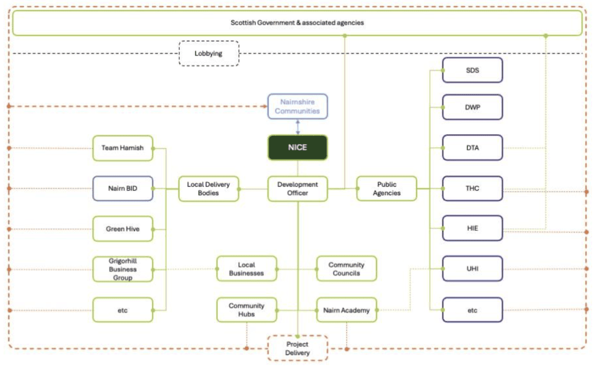
Acknowledgements
Preparation of this community led Local Place Plan was initiated and coordinated by Nairn Improvement Community Enterprise (NICE) as lead community body for the 5 local community council territories in Nairnshire, supported by a Steering Group comprising representatives from local Community Councils, Nairn BID and initial guidance from the team at neighbouring Black Isle Partnership who were already working on their Local Place Plan.
The Highland Council engaged Scottish charity Planning Aid Scotland, to lead community workshops and support independent drafting of the Nairnshire Local Place Plan from community content, and also provided advisory support to the steering group from a link officer from the Council’s Area Place Planning programme.
NICE and its community partners began community consultation in summer 2023 on a volunteer led basis, raising funds from local Community Councils, Businesses, Highland Council (Regeneration Fund and Ward Discretionary Fund), and Development Trusts Association Scotland to cover costs of surveys and public events and to pay part time staff from November 2023 to support the Community Engagement Process, manage communications, liaise with Highland Council and Planning Aid Scotland advisors, and coordinate, with the help of many Community Volunteers, all the activities which have contributed to bringing this Plan together.
Thanks for local donations for our match funding from Nairn River Community Council, Nairn West and Suburban Community Council, Ashers of Nairn, Gordons Timber, Nairn Golf Club and GF Job Ltd.
Thanks also to Nairn Community and Arts Centre, Nairn Dunbar Golf Club, Nairn Victoria Seaman's Hall, the Royal British Legion, Fornighty Hall, Auldearn Lethen Road Hall, Cawdor Community Hub, Croy Village Hall, and Nairn Academy for hosting community drop-in events and excellent home baking from Iris Thompson-Burton.
All content in this Local Place Plan has come from what the local community has told us they want for this place, not from NICE, its Steering Group partners or Highland Council.
Special thanks go to the hundreds of local people and community interest groups, including senior pupils of Nairn Academy, who helped to shape this Plan between summer 2023 and summer 2024.
This is your Plan.
Bibliography of Appendices
All appendices referenced here are either available directly from NICE, or directly from the relevant public body.
Nairnshire Local Place Plan Primary Research
Summaries of Responses from the Plan public engagement activities, including but not limited to surveys, drop ins, and workshops. Access to these documents available on request from LPP@nicenairn.org.uk .
Summaries of community responses on key themes:
Demography of respondents (age, residence) Vision for Nairnshire Housing Need Use of Development Land Jobs and Business Green Spaces and Getting Around Green Spaces and LeisureCommunity Led Research based on latest Public data and statistics
Climate Change and Coastal Erosion paper presented at May 2024 joint meeting of 2 Nairn CCs
Grigorhill Business Group Business Survey Report June 2024 and Business, Industry and Employment Growth strategyAdditional community submissions and datasets received during LPP public engagement
Cawdor Community Survey 2019 Nairn Town Centre Action Plan (2015)Keep Nairn Library Central Public Petition (1500 responses)
Grigorhill Business Group Business Survey Report June 2024 (part of Industry and Employment Growth strategy document above)
Nairn Jobs Network/Nairn BID employer survey report 2021 Green Hive Nairn Seaman's Victoria Hall Community Consultation Report 2022 Team Hamish Phase 2 (Putting Green area) NICE –2022 Options Appraisal for Regeneration of Nairn Town Centre NICE – 2022 Inspection Report on Old Social Work Building King Street THC Nairn Links Development Plan and Consultation Report(Nov19 Nshire Cttee) Team Hamish Vision Splashpad 2018 (Phase 1 of Links Development Plan) Team Hamish Phase 2 of Links Development 2022 Nairn Local Transport Survey 2014 Nairn Pumptrack Plan 2024 Nairn LIDO(Renewable Energy) 2017 Feasibility Study Nairn Woodlands and Wetlands Working Group proposals2015 Nairn Lochloy to A96 Community Consultation 2021Public Data Sources- relevant to Local Place Planning and Nairnshire
Local Development Planning and Local Place Plans:
National Planning Framework 4: https://www.gov.scot/publications/national-planning-framework-4/
Six Qualities of Successful Places: https://www.gov.scot/publications/national-planning-framework-4/pages/7/
Planning Circular 1/2022: https://www.gov.scot/publications/circular-1-2022-local-place-plans/
Highland Wide Local Development Plan: https://www.highland.gov.uk/info/178/development_plans/199/highland-wide_local_development_plan
Inner Moray Firth Local Development Plan 2 (IMFLDP2):
Scotland’s National Performance Framework: https://nationalperformance.gov.scot/
UN’s Sustainable Development Goals: https://sdgs.un.org/goals
Highland Indicative Regional Spatial Strategy: https://www.highland.gov.uk/info/178/development_plans/927/national_planning_framework/3
Community Planning and Economic Strategy:
Highlands and Islands Enterprise Strategy 2023-2028:
https://www.hie.co.uk/media/vczc0zca/hie-strategy-2023-28-final-031023.pdf
Highland Outcomes Improvement Plan 2017-2027: https://highlandcpp.org.uk/wp-content/uploads/2023/07/Highland-Outcome-Improvement-Plan-2017-2027.pdf.pagespeed.ce.yKzqetxvqR.pdf
Nairn Town and County Hospital: https://www.youtube.com/watch?v=JIAnHkrmw38
Population Data
Nairn and Nairnshire Demography 2022 (NHS Highland) Latest Scottish Census data 2022 2011 Census (searchable IV12 data map)Sustainable Futures (SF)
Scottish Government’s Flood Resilience Strategy Consultation: https://www.gov.scot/publications/flood-resilience-strategy-consultation/pages/1/
SEPA Flood Maps: https://map.sepa.org.uk/floodmaps/
Dynamic Coast Coastal Erosion Maps: https://www.dynamiccoast.com/webmaps SEPA flood risk assessment Nairn Central SEPA flood risk assessment Nairn West and Ardersier SEPA flood risk assessment Nairn East and Auldearn Dynamic Adaptive Pathways THC (Nairn Coast ) Nov23 Adaptation Scotland
Towns and Villages (TV)
Fishertown Conservation Area: https://her.highland.gov.uk/Designation/DHG5837
Cawdor Village Conservation Area https://her.highland.gov.uk/Designation/DHG5842
Listed Buildings Map: https://hesportal.maps.arcgis.com/apps/Viewer/index.html?appid=18d2608ac1284066ba3927312710d16d
Getting Around (GA)
Transport Scotland National Transport Strategy 2: https://www.transport.gov.scot/publication/national-transport-strategy-2/
Nairn Active Travel Masterplan: https://www.highland.gov.uk/downloads/file/24977/nairn_active_travel_masterplan_issue
Green Spaces and Leisure (GSL)
Nairn Common Good Asset Register: https://www.highland.gov.uk/downloads/file/23928/ nairn_-_common_good_asset_register
Nature Scot: https://www.nature.scot/
Bibliography of Images
Images (including Maps)
All images and graphics are produced and/or licensed by NICE or Ice Cream Architecture unless credited otherwise.
Cover Image
Figure 1 Cover graphic with images Dulsie Bridge, Cawdor Castle, Auldearn Doocot, aerial view Nairn beaches, Tibor Bandula for NICE
Foreword
Figure 2 Photo of Fergus Ewing, supplied by Fergus Ewing’s office
Section 2 Introduction
Figure 3 Nairnshire Local Place Plan boundary map, Ice Cream Architecture
Section 3 Nairnshire Today
Figure 4 A96 Traffic jam on St Ninian Road in Nairn, Inverness Courier
Figure 5 Nairn Central Beach, looking East showing the impact of 2023’s storms and sand movement, which have exposed the gabion baskets protecting the low-level dunes and footpath, NICE
Figure 6 Nairn County Community FC Soccer 7s summer festival July 2024, held at Nairn Links, Kenny Macleod
Figure 7 Crowds on King Street following the Nairn Games Opening Parade to the Links, Iain Fairweather
Figure 8 Nairn High Street, viewed from Lodgehill Road, Iain Fairweather
Figure 9 The Old Italianate School Dec 2023, NICE
Figure 10 Auldearn High Street, NICE
Figure 11 Lethen Road Hall, Auldearn, NICE
Figure 12 Cawdor Church, Google Street View
Figure 13 Cawdor Primary School and The Cawdor Hub, cawdorcommunitycentre.com
Figure 14 Fornighty Village Hall, NICE
Figure 15 Green Spaces of Nairn, Highland Council Nairn Town Centre Charrette 2014
Figure 16 Green Spaces Graphic, Ice Cream Architecture incorporating images of football, Kenny Macleod, with swans, seafront café, outdoor gym, Nairn beach, Iain Fairweather
Figure 17 Nairn Central Beach, showing 2023 storm damage to gabion baskets protecting footpath, NICE
Section 5 The Plan
Strategically Important Sites
Figure 18 Map Sites – Nairnshire, arcgis.com, Ordnance Survey Data, Crown Estates
Figure 19 Map Sites – Nairn, arcgis.com, Ordnance Survey Data, Crown Estates
Figure 20 Map Sites – Nairn Town Centre, arcgis.com, Ordnance Survey Data, Crown Estates
Sustainable Future
Jobs and Business
Getting Around
Figure 21 Nairn A96 by-pass proposed route, Transport Scotland
Figure 22 Map Site – Auldearn, arcgis.com, Ordnance Survey Data, Crown Estates
Figure 23 Map Site – Cawdor, arcgis.com, Ordnance Survey Data, Crown Estates
Figure 15 Green Spaces of Nairn, Highland Council Nairn Town Centre Charrette 2014
Section 6 – Context and Engagement
Figure 25 Graphic with Nairnshire images, sandcastle, outdoor gym, signposting, Courthouse, Riverside, woodland walk, Ice Cream Architecture incorporating photos by Iain Fairweather
Figure 26 Consultation Road Show at Lethen Road Hall, Auldearn, NICE
Figure 27 Nairn Games Day, image by Iain Fairweather
Figure 28 Consultation workshop at Nairn Academy, NICE
Figure 29 Consultation workshop at Nairn Community & Arts Centre, NICE
Section 7 Moving Forward Together
Figure 30 LPP delivery model and partners diagram, NICE